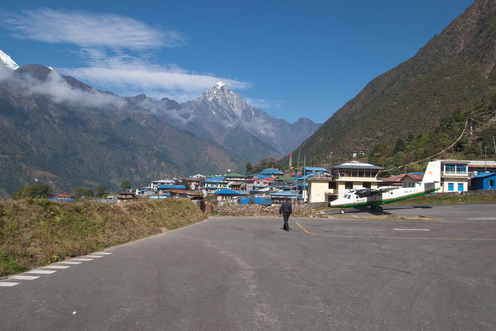
Lukla (Nepali: लुक्ला Nepali pronunciation: [ˈlukla]) is a small town in the Khumbu Pasanglhamu rural municipality of the Solukhumbu District in the Province No. 1 of northeastern Nepal. Situated at 2,860 metres (9,383 ft) above sea level, it is a popular place for visitors to the Himalayas near Mount Everest to arrive. Although Lukla means "place with many goats and sheep", few are found in the area nowadays. Lukla contains a small airport serving the region, and a variety of shops and lodges catering to tourists and trekkers, providing western-style meals and trail supplies. From Lukla, travellers need two days to reach the village of Namche Bazaar, an altitude-acclimatization stop for those continuing on. In August 2014, the Nepalese government announced plans to open the first tarmac road from Kathmandu to Lukla.
We use GPS information embedded into the photo when it is available.
3D mountains overlay
Adjust mountain panorama to perfectly match your photos because recorded by camera photo position might be imprecise.
Move tool
Rotate tool
Zoom
More customization
Choose which peak labels should make into the final photo and what photo title should be.
Next
Photo Location
Satellitte
Flat map
Relief map
Latitude
Longitude
Altitude
OR
Latitude
°'''
Longitude
°'''
Apply
Register Peak
Peak Name
Latitude
Longitude
Altitude
Register
Teleport
PeakVisor
This 3D model of Sagarmatha National Park in Nepal was made using the PeakVisor app topographic data. The mobile app features higher precision models worldwide, more topographic details, and works offline. Download PeakVisor maps today.
Download OBJ model
PeakVisor
The download should start shortly. If you find it useful please consider supporting the PeakVisor app.
PeakVisor for iOS and Android
Be a superhero of outdoor navigation with state-of-the-art 3D maps and mountain identification in the palm of your hand!