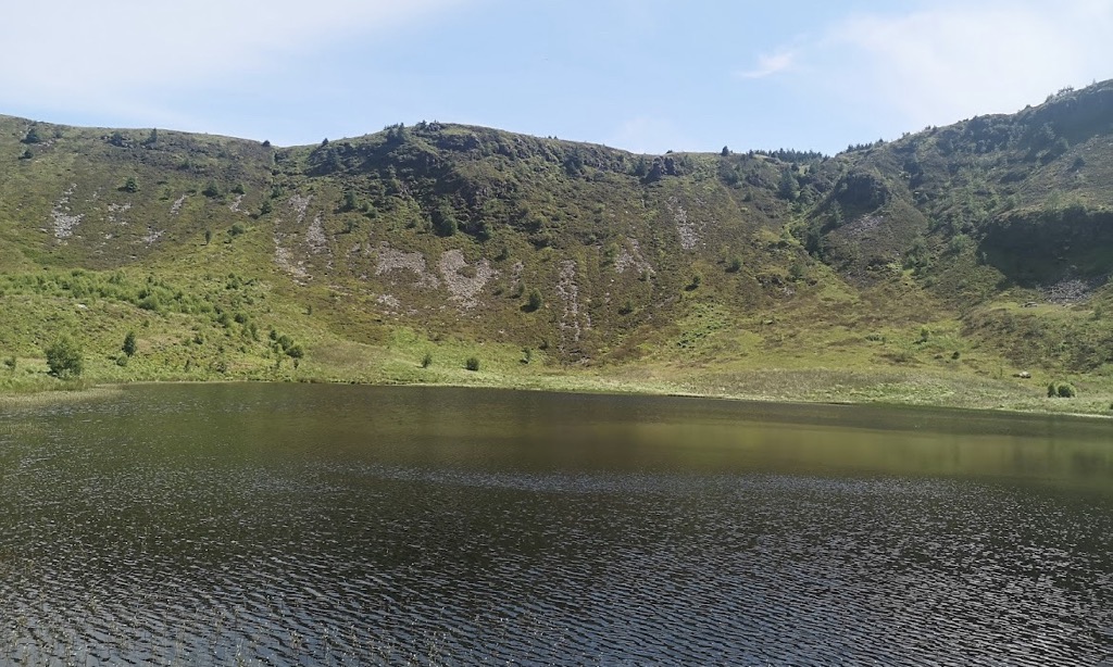
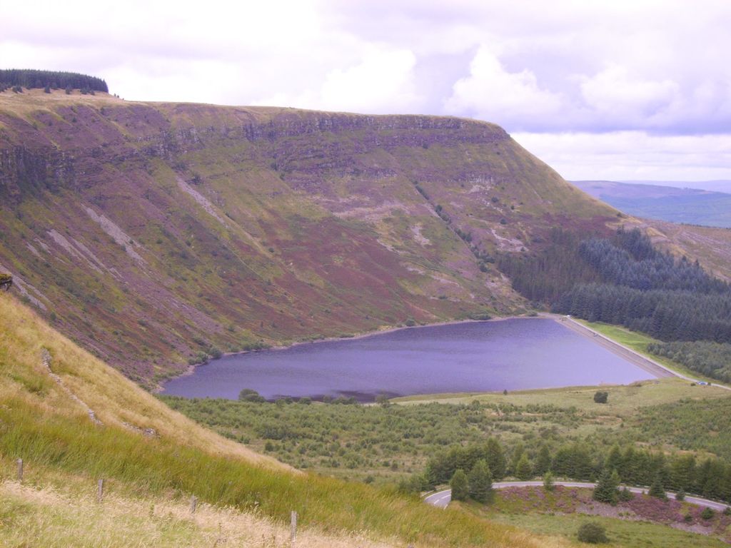
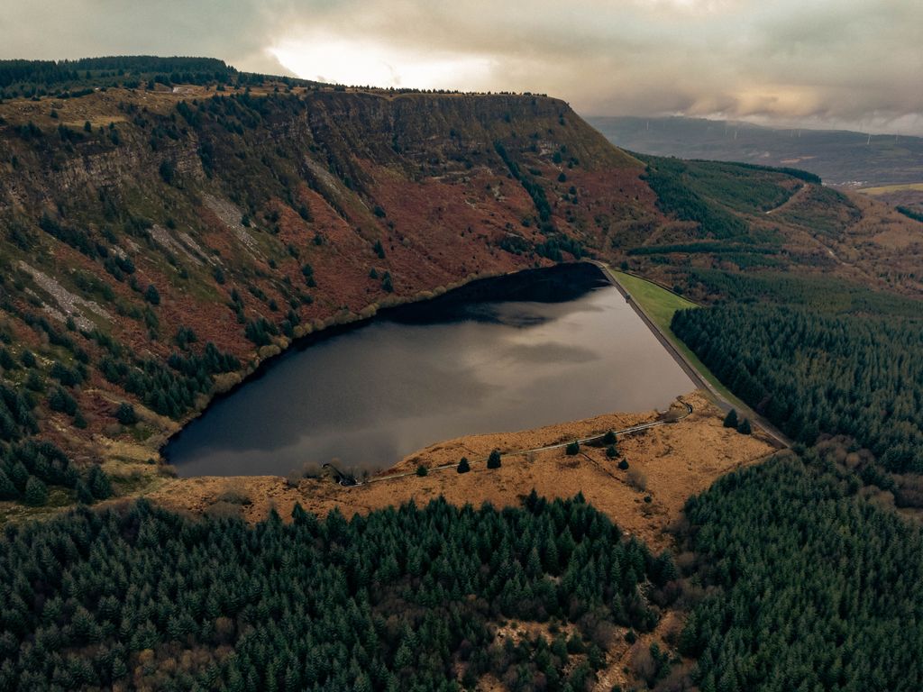
Llyn Fawr ('large lake' in Welsh) is a reservoir that occupies one of a series glacial cirques that form the northern escarpment of the South Wales Coalfield uplands, overlooking the heads of the Vale of Neath and the Cynon Valley, South Wales. It is known as the site of an important hoard of weapons and tools from the late Bronze Age and early Iron Age. It lies on the northern flanks of Craig-y-Llyn, a mountain that is designated as a Site of Special Scientific Interest. The western cirque contains Llyn Fach ('small lake'). While in government terms, it falls in the unitary authority of Rhondda Cynon Taf, in geographic terms it is actually in the Vale of Neath and its excess waters (all its water before conversion) flow into Nant Gwrelych, which flows into the River Neath at Pont Walby near Glynneath. Less than 1 km to the southeast and south lie the headwaters of the Rhondda Fawr and Rhondda Fach rivers, while 1.5 km to the southwest lie the headwaters of River Corrwg.
Show more
Sun and Moon
Mon
Tue
Wed
Thu
Fri
Sat
Sun
May 2022
Date and time
00:00
06:00
12:00
18:00
Today
--
--
Sunrise
--
Sunset
--
Moonrise
--
Moonset
Phase
🌔 Waxing Gibbous
The perfect light time for beautiful photos:
--
Sunrise
--
Sunset
PeakVisor app
Get the app on your smartphone
New Panorama Tools
Trace location on the map
Measure distances
All the instruments are available in the context menu as well.
We use GPS information embedded into the photo when it is available.
3D mountains overlay
Adjust mountain panorama to perfectly match your photos because recorded by camera photo position might be imprecise.
Move tool
Rotate tool
Zoom
More customization
Choose which peak labels should make into the final photo and what photo title should be.
Next
Photo Location
Satellitte
Flat map
Relief map
Latitude
Longitude
Altitude
OR
Latitude
°'''
Longitude
°'''
Apply
Register Peak
Peak Name
Latitude
Longitude
Altitude
Register
Teleport
PeakVisor
This 3D model of Sagarmatha National Park in Nepal was made using the PeakVisor app topographic data. The mobile app features higher precision models worldwide, more topographic details, and works offline. Download PeakVisor maps today.
Download OBJ model
PeakVisor
The download should start shortly. If you find it useful please consider supporting the PeakVisor app.
PeakVisor for iOS and Android
Be a superhero of outdoor navigation with state-of-the-art 3D maps and mountain identification in the palm of your hand!