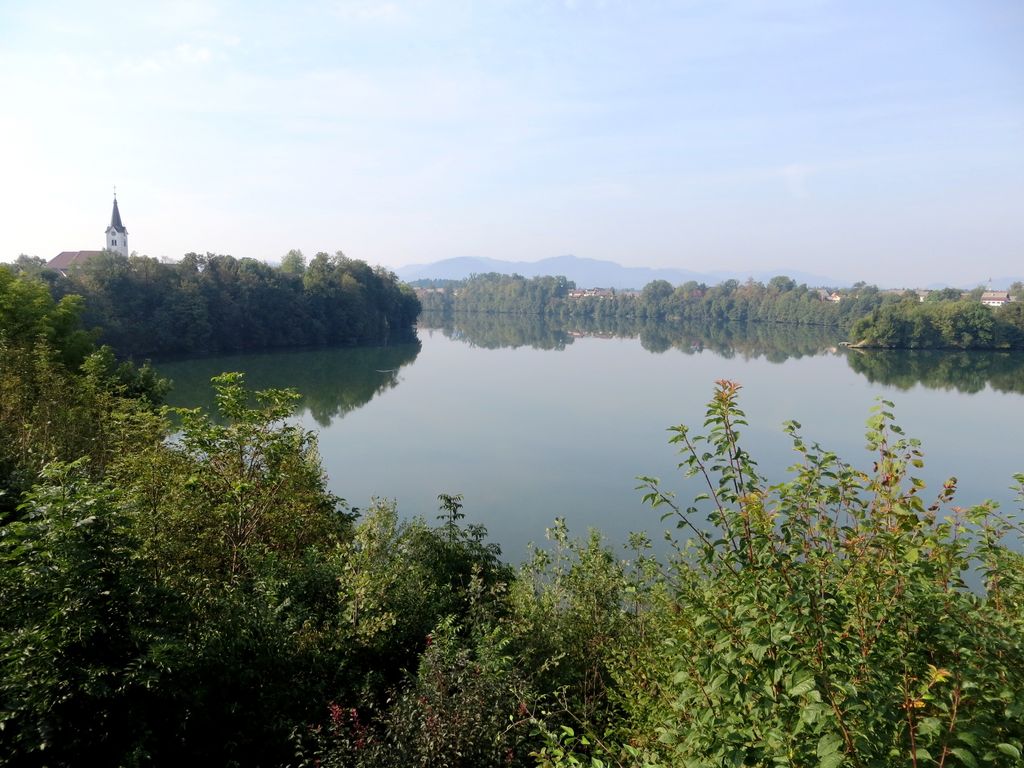
Lake Trboje (Slovene: Trbojsko jezero), also named Lake Mavčiče (Mavčiško jezero) and Lake Kranj (Kranjsko jezero), is an artificial lake west of the village of Trboje in the Municipality of Šenčur, northwestern Slovenia. It was created in 1986 as a reservoir for the Mavčiče Hydroelectric Plant by damming the Sava River. The lake, which belongs to the Municipalities of Šenčur, Kranj, and Medvode, covers an area of 1 square kilometre (0.39 sq mi) and is up to 17 metres (56 ft) deep. As the lake submerged part of the Zarica Gorge of the Sava, it is surrounded by steep banks, with conglomerate cliffs in the northern part. A number of villages lie at the lake: from the south towards the north, they are Moše, Trboje and Žerjavka on the east side, and Mavčiče, Praše, and Jama on the west side. The lake is renowned by its fauna, which includes numerous fish (particularly carp) and about 140 species of birds. It is a rare and the biggest nesting place of the common merganser in Slovenia. The flora features a number of alpine species, among them the edelweiss. It is a popular place for fishing and boating.
We use GPS information embedded into the photo when it is available.
3D mountains overlay
Adjust mountain panorama to perfectly match your photos because recorded by camera photo position might be imprecise.
Move tool
Rotate tool
Zoom
More customization
Choose which peak labels should make into the final photo and what photo title should be.
Next
Photo Location
Satellitte
Flat map
Relief map
Latitude
Longitude
Altitude
OR
Latitude
°'''
Longitude
°'''
Apply
Register Peak
Peak Name
Latitude
Longitude
Altitude
Register
Teleport
PeakVisor
This 3D model of Sagarmatha National Park in Nepal was made using the PeakVisor app topographic data. The mobile app features higher precision models worldwide, more topographic details, and works offline. Download PeakVisor maps today.
Download OBJ model
PeakVisor
The download should start shortly. If you find it useful please consider supporting the PeakVisor app.
PeakVisor for iOS and Android
Be a superhero of outdoor navigation with state-of-the-art 3D maps and mountain identification in the palm of your hand!


.jpg)