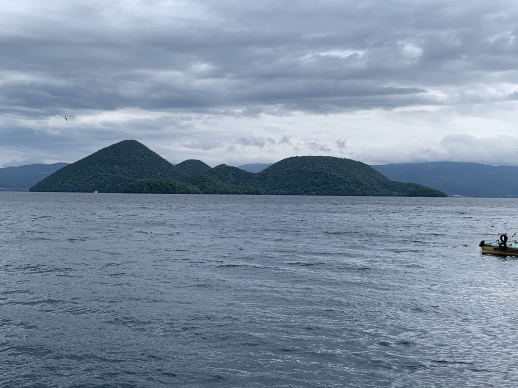
Lake Tōya (洞爺湖, Tōya-ko) is a volcanic caldera lake in Shikotsu-Toya National Park, Abuta District, Hokkaidō, Japan. It is part of "Toya Caldera and Usu Volcano Global Geopark" which joins in Global Geoparks Network. The stratovolcano of Mount Usu lies on the southern rim of the caldera. The lake is nearly circular, being 10 kilometers in diameter from the eastwest and 9 kilometers from the northsouth. The town of Tōyako comprises most of the area surrounding the lake and the town of Sōbetsu is located on the eastern side. Lake Tōya is said to be the northernmost lake in Japan that never ices (with competing claim by nearby Lake Shikotsu), and the second most transparent lake in Japan. Nakajima Island (not to be confused with another island of the same name in Lake Kussharo) is a recursive island in the middle of the lake which houses the Tōya Lake Forest Museum. Lake Tōya was called Kim'un-to (キムウン (kim'un) means "in the mountain" and ト (to) means "lake") by the Ainu. In the Meiji era, Japanese pioneers named the lake Tōya after the Ainu expression to ya, which means "lakeshore, land around a lake." The 2008 G8 Summit was held at Lake Tōya and The Windsor Hotel Toya Resort & Spa.
Show more
Sun and Moon
Mon
Tue
Wed
Thu
Fri
Sat
Sun
May 2022
Date and time
00:00
06:00
12:00
18:00
Today
--
--
Sunrise
--
Sunset
--
Moonrise
--
Moonset
Phase
🌔 Waxing Gibbous
The perfect light time for beautiful photos:
--
Sunrise
--
Sunset
PeakVisor app
Get the app on your smartphone
New Panorama Tools
Trace location on the map
Measure distances
All the instruments are available in the context menu as well.
We use GPS information embedded into the photo when it is available.
3D mountains overlay
Adjust mountain panorama to perfectly match your photos because recorded by camera photo position might be imprecise.
Move tool
Rotate tool
Zoom
More customization
Choose which peak labels should make into the final photo and what photo title should be.
Next
Photo Location
Satellitte
Flat map
Relief map
Latitude
Longitude
Altitude
OR
Latitude
°'''
Longitude
°'''
Apply
Register Peak
Peak Name
Latitude
Longitude
Altitude
Register
Teleport
PeakVisor
This 3D model of Sagarmatha National Park in Nepal was made using the PeakVisor app topographic data. The mobile app features higher precision models worldwide, more topographic details, and works offline. Download PeakVisor maps today.
Download OBJ model
PeakVisor
The download should start shortly. If you find it useful please consider supporting the PeakVisor app.
PeakVisor for iOS and Android
Be a superhero of outdoor navigation with state-of-the-art 3D maps and mountain identification in the palm of your hand!