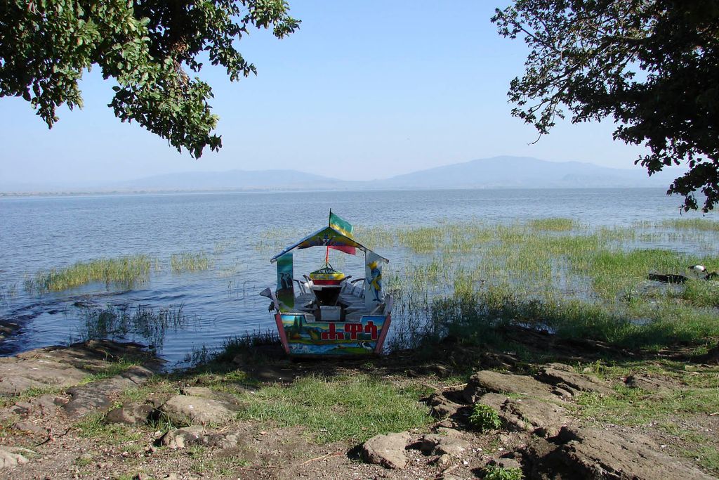
Lake Hawassa or Awasa, is an endorheic basin in Sidama Region of Ethiopia, located in the Main Ethiopian Rift south of Addis Ababa, the capital city of the country. According to the Statistical Abstract of Ethiopia for 1967/68, the lake is 16 km long and 9 km wide, with a surface area of 129 square kilometers. It has a maximum depth of 10 meters and is located at an elevation of 1,708 meters. It is located inside the Awasa Caldera. Because it is relatively accessible to scientists, Lake Hawassa is the most studied of the Rift Valley lakes in Ethiopia. According to William Taylor, a member of the African Lakes and Rivers Research Group at the University of Waterloo, Lake Hawassa is, despite its lack of an outflow, "essentially a freshwater lake (conductivity is variable, but less than 1,000) indicating that it must have a subterranean outlet."
We use GPS information embedded into the photo when it is available.
3D mountains overlay
Adjust mountain panorama to perfectly match your photos because recorded by camera photo position might be imprecise.
Move tool
Rotate tool
Zoom
More customization
Choose which peak labels should make into the final photo and what photo title should be.
Next
Photo Location
Satellitte
Flat map
Relief map
Latitude
Longitude
Altitude
OR
Latitude
°'''
Longitude
°'''
Apply
Register Peak
Peak Name
Latitude
Longitude
Altitude
Register
Teleport
PeakVisor
This 3D model of Sagarmatha National Park in Nepal was made using the PeakVisor app topographic data. The mobile app features higher precision models worldwide, more topographic details, and works offline. Download PeakVisor maps today.
Download OBJ model
PeakVisor
The download should start shortly. If you find it useful please consider supporting the PeakVisor app.
PeakVisor for iOS and Android
Be a superhero of outdoor navigation with state-of-the-art 3D maps and mountain identification in the palm of your hand!