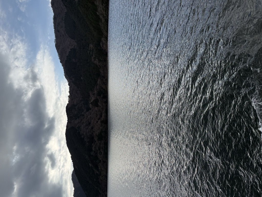
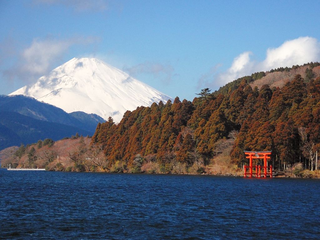
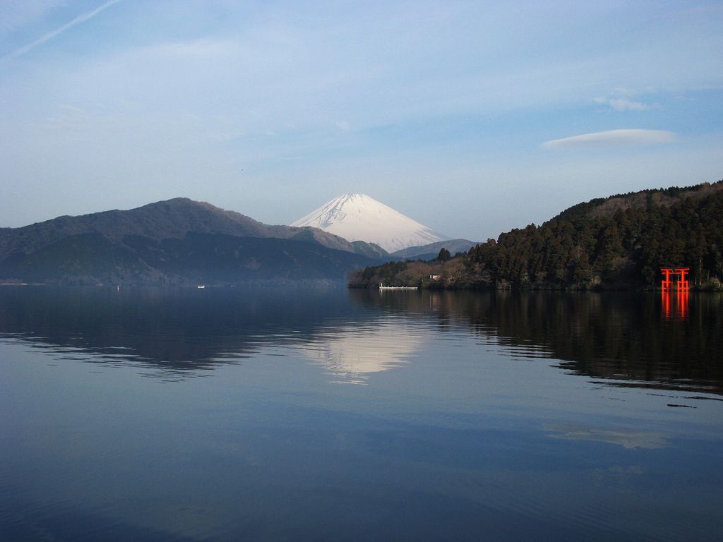
Lake Ashi (芦ノ湖, Ashi-no-ko), also referred to as Hakone Lake or Ashinoko Lake, is a scenic lake in the Hakone area of Kanagawa Prefecture in Honshū, Japan. It is a crater lake that lies along the southwest wall of the caldera of Mount Hakone, a complex volcano that last erupted in 1170 CE at Ōwakudani. The lake is known for its views of Mount Fuji, its numerous hot springs, historical sites, and ryokan. The lake is located on the Tōkaidō road, the main link between Kyoto and Tokyo. A number of pleasure boats and ferries traverse the lake, providing scenic views for tourists and passengers. Several of the boats are inspired by the design of sailing warships. Most visitors to Lake Ashi stay in one of the hotels or ryokan located in the area to visit some of the local attractions. There is also a campsite at the north end of the lake. Hakone Shrine is a shrine that has been visited by shōgun, samurai, and many travelers over the centuries. Large sections of the Old Tōkaidō road are preserved here. Onshi Park was the summer retreat for the imperial family that is now a public park. Taking the aerial tram Hakone Ropeway to The Great Boiling Valley. From Togendai on Lake Ashi, the Hakone Ropeway aerial tram connects to Sounzan, the upper terminus of the Hakone Tozan Cable Car funicular railway. This in turn connects to the Hakone Tozan Line mountain railway for the descent to Odawara and a connection to Tokyo by the Tōkaidō Shinkansen. Visitors can also take the Hakone Sightseeing Cruise with its pirate ships from Togendai to Moto-Hakone Port and Hakone-Machi Port on opposite ends of the lake. The cruise line began in 1950. The name means "lake of reeds" in Japanese: 芦 (ashi) is "reed", and 湖 (ko) is "lake". The abundance of nature makes it popular with hikers. There are many trails with different levels of challenge. Lake Ashi is emptied by the Fukara Aqueduct toward Susono, Shizuoka since its completion in 1670, not by the Haya River toward Odawara, Kanagawa.
Show more
Sun and Moon
Mon
Tue
Wed
Thu
Fri
Sat
Sun
May 2022
Date and time
00:00
06:00
12:00
18:00
Today
--
--
Sunrise
--
Sunset
--
Moonrise
--
Moonset
Phase
🌔 Waxing Gibbous
The perfect light time for beautiful photos:
--
Sunrise
--
Sunset
PeakVisor app
Get the app on your smartphone
New Panorama Tools
Trace location on the map
Measure distances
All the instruments are available in the context menu as well.
We use GPS information embedded into the photo when it is available.
3D mountains overlay
Adjust mountain panorama to perfectly match your photos because recorded by camera photo position might be imprecise.
Move tool
Rotate tool
Zoom
More customization
Choose which peak labels should make into the final photo and what photo title should be.
Next
Photo Location
Satellitte
Flat map
Relief map
Latitude
Longitude
Altitude
OR
Latitude
°'''
Longitude
°'''
Apply
Register Peak
Peak Name
Latitude
Longitude
Altitude
Register
Teleport
PeakVisor
This 3D model of Sagarmatha National Park in Nepal was made using the PeakVisor app topographic data. The mobile app features higher precision models worldwide, more topographic details, and works offline. Download PeakVisor maps today.
Download OBJ model
PeakVisor
The download should start shortly. If you find it useful please consider supporting the PeakVisor app.
PeakVisor for iOS and Android
Be a superhero of outdoor navigation with state-of-the-art 3D maps and mountain identification in the palm of your hand!