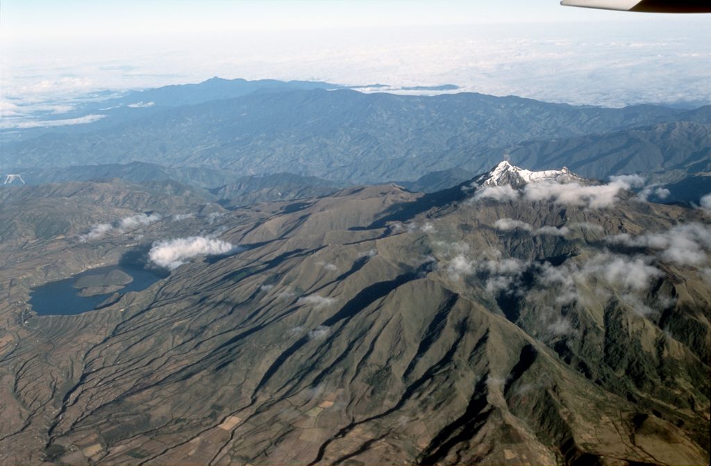
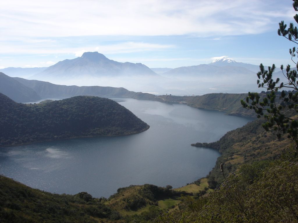
Cuicocha (Kichwa: Kuykucha, "lake of guinea pigs" or Kuychikucha, "rainbow lake") is a 3 km (2 mi) wide caldera and crater lake at the foot of Cotacachi Volcano in the Cordillera Occidental of the Ecuadorian Andes. Its name comes from the Kichwa indigenous language and means "Lago del Cuy" or Guinea Pig Lake in English. It was given this name due to the guinea pig shape of the largest Island in the middle of the laguna. These animals play a significant part in the everyday life of Ecuadorians, as they reproduce rapidly and need a minimum of food and care to survive. They make for a high protein meal especially for populations living in high altitude. The caldera was created by a massive eruption about 3100 years ago that generated about 5 cubic kilometres (6.54 billion cubic yards) of pyroclastic flow and covered the surrounding area in volcanic ash up to 20 cm (8 inches) deep. Activity continued until 650 CE. In combination with other eruptions from nearby Imbabura, Mojanda, Cotacachi, and Cayambe, Cuicocha is responsible for the fertile soil of the Otavalo Valley. Cuicocha lake, a crater lake within the Cuicocha caldera contains four dacitic lava domes which form two steep forested islands: Yerovi, the smaller, and Teodoro Wolf, the larger. People are prohibited on both. The rim of the caldera is extremely steep — so steep, in fact, that the accumulation of sediment is insufficient for most hydrophyte vegetation. An older lava dome from the Pleistocene forms part of the eastern rim. The lake, which is 200 m (656 ft) deep at its deepest point, is highly alkaline and contains little life. It has no known outlet. The intra-caldera islands, on the other hand, support some wildlife, most notably the silvery grebe, which lives around the reeds and feeds on small fish, frogs, crayfish, small water snakes, seeds of water plants, and insects. The bird is found in upper temperate and lower páramo zones throughout the Andes, but little is known about the species. In 1974 a census was taken of the population of grebes at Cuicocha and 44 birds were found. Cuicocha forms the southern end of the Cotacachi-Cayapas Ecological Reserve. During the second day of Inti Raymi (or Sun Festival) every summer solstice, indigenous shamans use Cuicocha as a bath for ritual cleansing and purification.
We use GPS information embedded into the photo when it is available.
3D mountains overlay
Adjust mountain panorama to perfectly match your photos because recorded by camera photo position might be imprecise.
Move tool
Rotate tool
Zoom
More customization
Choose which peak labels should make into the final photo and what photo title should be.
Next
Photo Location
Satellitte
Flat map
Relief map
Latitude
Longitude
Altitude
OR
Latitude
°'''
Longitude
°'''
Apply
Register Peak
Peak Name
Latitude
Longitude
Altitude
Register
Teleport
PeakVisor
This 3D model of Sagarmatha National Park in Nepal was made using the PeakVisor app topographic data. The mobile app features higher precision models worldwide, more topographic details, and works offline. Download PeakVisor maps today.
Download OBJ model
PeakVisor
The download should start shortly. If you find it useful please consider supporting the PeakVisor app.
PeakVisor for iOS and Android
Be a superhero of outdoor navigation with state-of-the-art 3D maps and mountain identification in the palm of your hand!