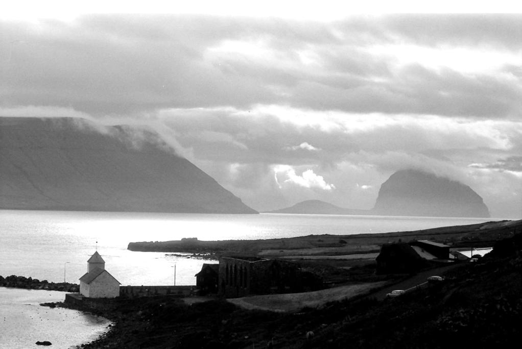
Kirkjubøur (Danish: Kirkebø) is the southernmost village on Streymoy, Faroe Islands. The village is located on the south-west coast of Streymoy and has a view towards the islands of Hestur and Koltur towards the west, and to Sandoy towards the south. It lies south of the new ferry port of Gamlarætt, which opened in 1993. The village is the Faroes' most important historical site, with the ruins of the Magnus Cathedral from around 1300, Saint Olav's Church (Olavskirkjan), from the 12th century and the old farmhouse of Kirkjubøargarður from the 11th century. In 1832, a runestone was found near the Magnus Cathedral in Kirkjubøur. The stone which is referred to as the Kirkjubøur stone dates back to the Viking Age. The little islet just of the coast, Kirkjubøhólmur, contains an eiderduck colony. To the village belongs the islet of Trøllhøvdi, just 100m off the northern tip of Sandoy 9 km away from Kirkjubøur. It was given as payment to the villagers, as it was their duty to ferry people across to Sandoy in medieval times.
Show more
Sun and Moon
Mon
Tue
Wed
Thu
Fri
Sat
Sun
May 2022
Date and time
00:00
06:00
12:00
18:00
Today
--
--
Sunrise
--
Sunset
--
Moonrise
--
Moonset
Phase
🌔 Waxing Gibbous
The perfect light time for beautiful photos:
--
Sunrise
--
Sunset
PeakVisor app
Get the app on your smartphone
New Panorama Tools
Trace location on the map
Measure distances
All the instruments are available in the context menu as well.
We use GPS information embedded into the photo when it is available.
3D mountains overlay
Adjust mountain panorama to perfectly match your photos because recorded by camera photo position might be imprecise.
Move tool
Rotate tool
Zoom
More customization
Choose which peak labels should make into the final photo and what photo title should be.
Next
Photo Location
Satellitte
Flat map
Relief map
Latitude
Longitude
Altitude
OR
Latitude
°'''
Longitude
°'''
Apply
Register Peak
Peak Name
Latitude
Longitude
Altitude
Register
Teleport
PeakVisor
This 3D model of Sagarmatha National Park in Nepal was made using the PeakVisor app topographic data. The mobile app features higher precision models worldwide, more topographic details, and works offline. Download PeakVisor maps today.
Download OBJ model
PeakVisor
The download should start shortly. If you find it useful please consider supporting the PeakVisor app.
PeakVisor for iOS and Android
Be a superhero of outdoor navigation with state-of-the-art 3D maps and mountain identification in the palm of your hand!


.jpg)
.jpg)


