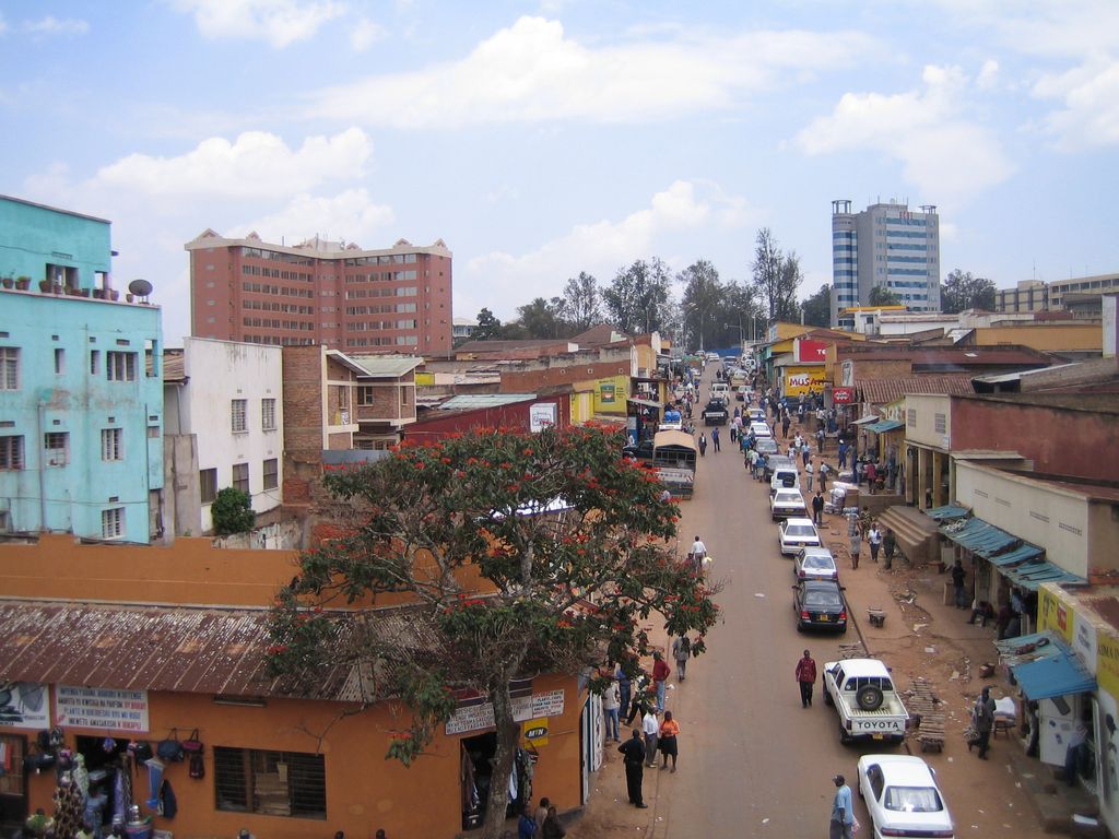
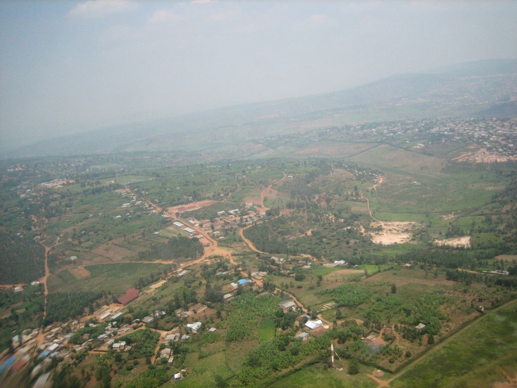
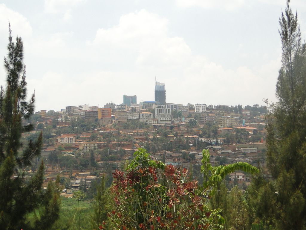
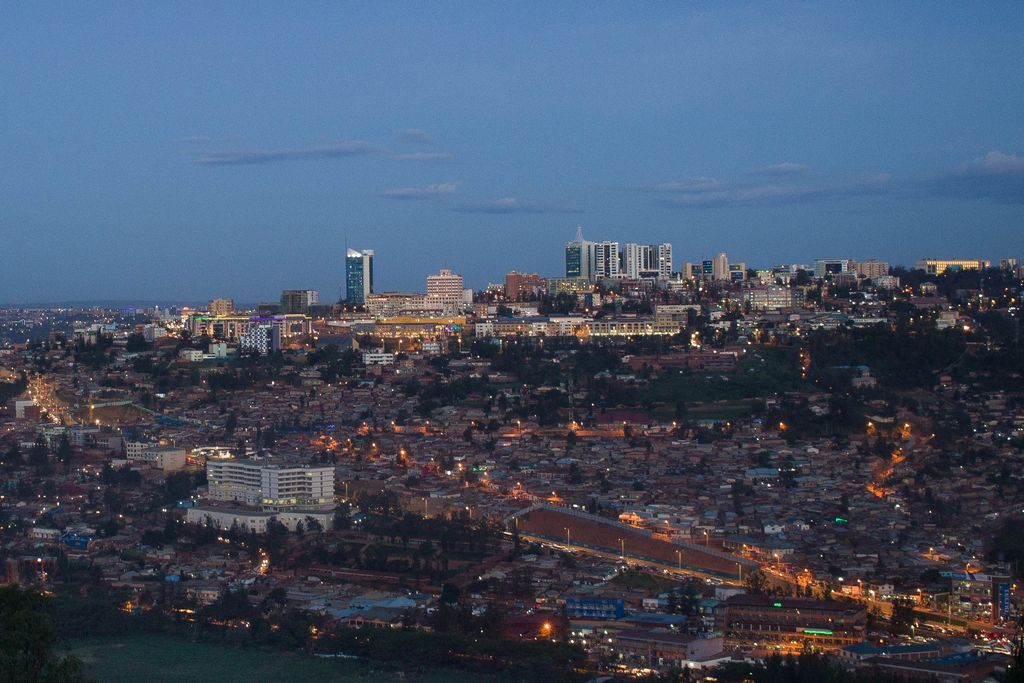
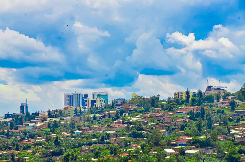
Kigali (Kinyarwanda pronunciation: [ci.ɡɑ́.ɾi]) is the capital and largest city of Rwanda. It is near the nation's geographic centre in a region of rolling hills, with a series of valleys and ridges joined by steep slopes. As a primate city, Kigali is a relatively new city. It has been Rwanda's economic, cultural, and transport hub since it was founded as an administrative outpost in 1907, and became the capital of the country at independence in 1962, shifting focus away from Huye. In an area controlled by the Kingdom of Rwanda from the 15th century, and then, by the German Empire in the beginning of the 20th century, the city was founded in 1907 when Richard Kandt, the colonial resident, chose the site for his headquarters, citing its central location, views and security. Foreign merchants began to trade in the city during the German era, and Kandt opened some government-run schools for Tutsi Rwandan students. Belgium took control of Rwanda and Burundi during World War I, forming the mandate of Ruanda-Urundi. Kigali remained the seat of colonial administration for Rwanda but Ruanda-Urundi's capital was at Usumbura (now Bujumbura) in Burundi and Kigali remained a small city with a population of just 6,000 at the time of independence. Kigali grew slowly during the following decades. It was not initially directly affected by the Rwandan Civil War between government forces and the rebel Rwandan Patriotic Front (RPF), which began in 1990. However, in April 1994 Rwanda's President Juvénal Habyarimana was killed when his aircraft was shot down near Kigali. His death was followed by the Rwandan genocide, with Hutu extremists loyal to the interim government killing an estimated 800,000-1,000,000 Tutsi and moderate Hutu nationwide. The RPF resumed fighting, ending a cease-fire of more than a year. They gradually took control of most of the country and seized Kigali on 4 July 1994. Post-genocide Kigali has experienced rapid population growth, with much of the city rebuilt. The city of Kigali is one of the five provinces of Rwanda, with boundaries set in 2006. It is divided into three districts—Gasabo, Kicukiro, and Nyarugenge—which historically had control of significant areas of local governance. Reforms in January 2020 transferred much of the districts' power to the city-wide council. The city also hosts the main residence and offices of the president of Rwanda and most government ministries. The largest contributor to Kigali's gross domestic product is the service sector, but a significant proportion of the population works in agriculture including small-scale subsistence farming. Attracting international visitors is a priority for city authorities, including leisure tourism, conferences and exhibitions.
Show more
Sun and Moon
Mon
Tue
Wed
Thu
Fri
Sat
Sun
May 2022
Date and time
00:00
06:00
12:00
18:00
Today
--
--
Sunrise
--
Sunset
--
Moonrise
--
Moonset
Phase
🌔 Waxing Gibbous
The perfect light time for beautiful photos:
--
Sunrise
--
Sunset
PeakVisor app
Get the app on your smartphone
New Panorama Tools
Trace location on the map
Measure distances
All the instruments are available in the context menu as well.
We use GPS information embedded into the photo when it is available.
3D mountains overlay
Adjust mountain panorama to perfectly match your photos because recorded by camera photo position might be imprecise.
Move tool
Rotate tool
Zoom
More customization
Choose which peak labels should make into the final photo and what photo title should be.
Next
Photo Location
Satellitte
Flat map
Relief map
Latitude
Longitude
Altitude
OR
Latitude
°'''
Longitude
°'''
Apply
Register Peak
Peak Name
Latitude
Longitude
Altitude
Register
Teleport
PeakVisor
This 3D model of Sagarmatha National Park in Nepal was made using the PeakVisor app topographic data. The mobile app features higher precision models worldwide, more topographic details, and works offline. Download PeakVisor maps today.
Download OBJ model
PeakVisor
The download should start shortly. If you find it useful please consider supporting the PeakVisor app.
PeakVisor for iOS and Android
Be a superhero of outdoor navigation with state-of-the-art 3D maps and mountain identification in the palm of your hand!