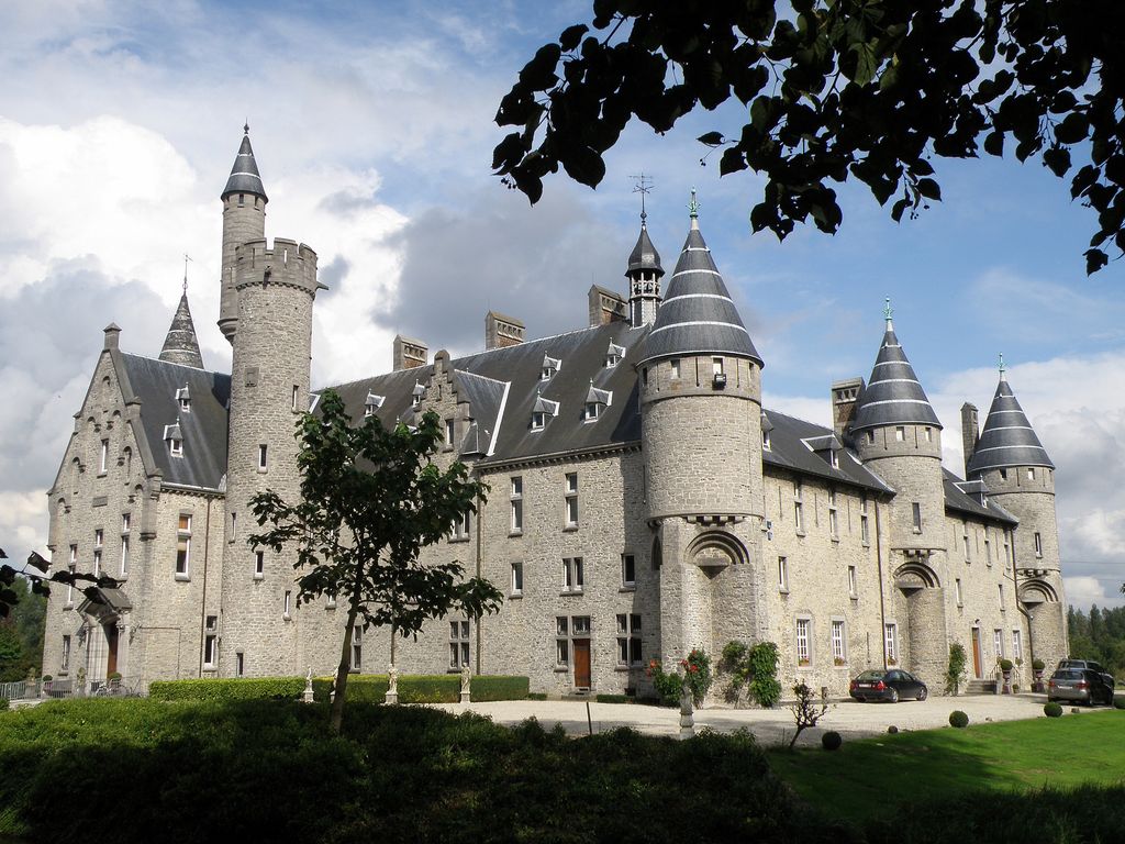
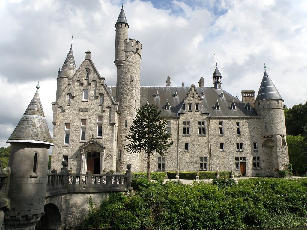
Bornem Castle, also known as the Marnix de Sainte-Aldegonde Castle (Dutch: Kasteel van Bornem, or Kasteel Marnix de Sainte-Aldegonde), is a country house, formerly a castle, located in Bornem, province of Antwerp, Belgium. Bornem Castle is situated at an elevation of 1 meters. The building stands on the Oude Schelde, a tributary of the Scheldt. The earliest fortification on the site was of the 10th or 11th centuries and was intended to defend against the incursions of the Vikings. A manor house was built on the foundations of the older building in 1587 by the Spanish nobleman Pedro Coloma, Baron of Bornhem and lord of Bobadilla, a follower of Alexander Farnese. The property was afterwards leased by the family de Marnix de Sainte-Aldegonde, who became the outright owners in 1773. The present house was built on the same site at the end of the 19th century to plans by Hendrik Beyaert, after the remains of the 16th-century building had been demolished. It remains in ownership of the house Marnix de Sainte-Aldegonde, the current resident is John de Marnix de Sainte-Aldegonde, 14th Count of Bornem. Pedro Coloma, Baron of Bornhem Alexandre Coloma, second baron of Bornhem Pierre Coloma, Viscount of Dourlens, third baron of Bornhem Jean-François Coloma, fourth baron and (1658) 1st Count of Bornhem François-Claude Coloma, 2nd Count of Bornhem Charles-Joseph-François Coloma, 3rd Count of Bornhem, died 1724 Marie-Florence Coloma, 4th Countess of Bornhem Aldegonde-Eleonore de Lannoy; Lady of Bornem: marr. Baudry-Adelbert de Marnix. List of castles in Belgium Media related to Kasteel Marnix de Sainte-Aldegonde at Wikimedia Commons Official website Bouwkundig Erfgoed Vlaanderen (in Dutch)
Show more
Sun and Moon
Mon
Tue
Wed
Thu
Fri
Sat
Sun
May 2022
Date and time
00:00
06:00
12:00
18:00
Today
--
--
Sunrise
--
Sunset
--
Moonrise
--
Moonset
Phase
🌔 Waxing Gibbous
The perfect light time for beautiful photos:
--
Sunrise
--
Sunset
PeakVisor app
Get the app on your smartphone
New Panorama Tools
Trace location on the map
Measure distances
All the instruments are available in the context menu as well.
We use GPS information embedded into the photo when it is available.
3D mountains overlay
Adjust mountain panorama to perfectly match your photos because recorded by camera photo position might be imprecise.
Move tool
Rotate tool
Zoom
More customization
Choose which peak labels should make into the final photo and what photo title should be.
Next
Photo Location
Satellitte
Flat map
Relief map
Latitude
Longitude
Altitude
OR
Latitude
°'''
Longitude
°'''
Apply
Register Peak
Peak Name
Latitude
Longitude
Altitude
Register
Teleport
PeakVisor
This 3D model of Sagarmatha National Park in Nepal was made using the PeakVisor app topographic data. The mobile app features higher precision models worldwide, more topographic details, and works offline. Download PeakVisor maps today.
Download OBJ model
PeakVisor
The download should start shortly. If you find it useful please consider supporting the PeakVisor app.
PeakVisor for iOS and Android
Be a superhero of outdoor navigation with state-of-the-art 3D maps and mountain identification in the palm of your hand!