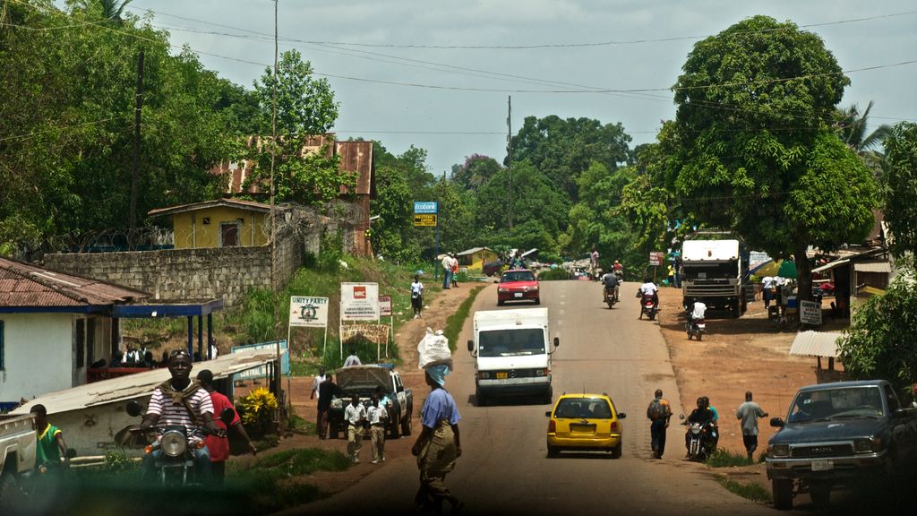
Kakata is the capital city of Liberia's Margibi County. Located in Kakata District, its proximity to the Du River bridge also comprises its border with Todee District. It is a transit town at the heart of the historical natural rubber cultivation belt in Liberia. The city is colloquially known as "Kak City". It is estimated that the city is surrounded by more than one hundred thousand acres of rubber plantations, most of which are now past latex production. Though the Salala Rubber Company and Firestone Liberia are not far from Kakata, the nearby rubber plantations are mostly privately owned. Morris American Rubber Company (MARCO) and Bright Farm are the two largest plantations by area around Kakata. Small and medium rubber plantations also dot most of the landscape. Kakata has many primary and secondary schools. One of the most notable is Booker Washington Institute (BWI), Liberia's premier vocational high school and technical institution. It also hosts Kakata Rural Teacher Training Institute, which trains Liberian elementary, lower-grade and secondary teachers. C. H. Rennie Hospital in Kakata is the only government referral hospital in the County and it is the headquarters for the Margibi County health team. The Firestone Duside Hospital in Harbel is the nearest referral health care facility. Kakata has a large daily market in the center of town. As of the 2008 census, Kakata has a population of 33,945. Of this, 16,501 were male and 17,444 female. It is the fifth most populous urban area in Liberia.
Show more
Sun and Moon
Mon
Tue
Wed
Thu
Fri
Sat
Sun
May 2022
Date and time
00:00
06:00
12:00
18:00
Today
--
--
Sunrise
--
Sunset
--
Moonrise
--
Moonset
Phase
🌔 Waxing Gibbous
The perfect light time for beautiful photos:
--
Sunrise
--
Sunset
PeakVisor app
Get the app on your smartphone
New Panorama Tools
Trace location on the map
Measure distances
All the instruments are available in the context menu as well.
We use GPS information embedded into the photo when it is available.
3D mountains overlay
Adjust mountain panorama to perfectly match your photos because recorded by camera photo position might be imprecise.
Move tool
Rotate tool
Zoom
More customization
Choose which peak labels should make into the final photo and what photo title should be.
Next
Photo Location
Satellitte
Flat map
Relief map
Latitude
Longitude
Altitude
OR
Latitude
°'''
Longitude
°'''
Apply
Register Peak
Peak Name
Latitude
Longitude
Altitude
Register
Teleport
PeakVisor
This 3D model of Sagarmatha National Park in Nepal was made using the PeakVisor app topographic data. The mobile app features higher precision models worldwide, more topographic details, and works offline. Download PeakVisor maps today.
Download OBJ model
PeakVisor
The download should start shortly. If you find it useful please consider supporting the PeakVisor app.
PeakVisor for iOS and Android
Be a superhero of outdoor navigation with state-of-the-art 3D maps and mountain identification in the palm of your hand!