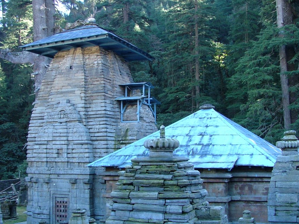
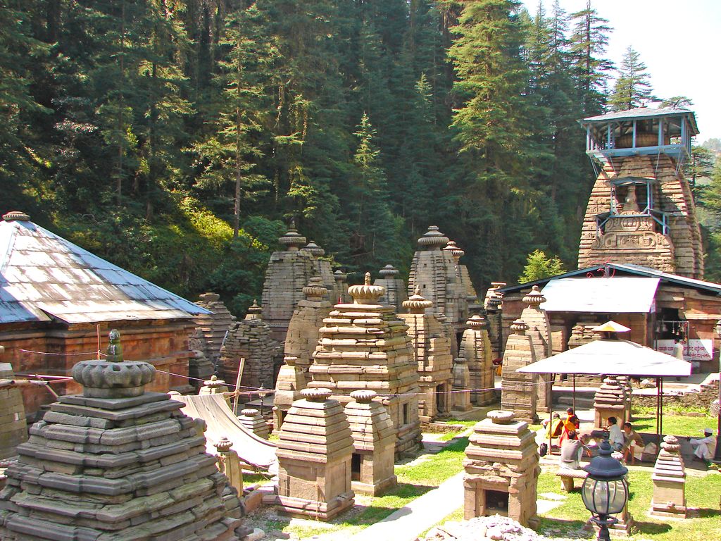
Jageshwar is a Hindu pilgrimage town near Almora in Almora district of the Himalayan Indian state of Uttarakhand. It is one of the Dhams (pilgrimage region) in the Shaivism tradition. The site is protected under Indian laws, and managed by the Archaeological Survey of India (ASI). It includes Dandeshwar Temple, Chandi-ka-Temple, Jageshwar Temple, Kuber Temple, Mritunjaya Temple, Nanda Devi or Nau Durga, Nava-grah temple, a Pyramidal shrine, and Surya Temple. The site celebrates the Jageshwar Monsoon Festival during the Hindu calendar month of Shravan (overlaps with July–August) and the annual Maha Shivratri Mela (Shivratri festival), which takes place in early spring. Jageshwar Temples, also referred to as Jageswar Temples or Jageshwar Valley Temples, are a group of 125 ancient Hindu temples dated between 7th and 14th century, The valley has a number of temple clusters such as the Dandeshwar and Jageshwar sites. Some locations have attracted construction of new temples through the 20th-century. Together these clusters over the valley consist of over 200 structural temples built from cut stone. Many are small, while a few are substantial. They predominantly illustrate North Indian Nagara style of architecture with a few exceptions that show South and Central Indian style designs, many are dedicated to god Shiva, while others in immediate vicinity are dedicated to god Vishnu, Shakti goddesses and Surya traditions of Hinduism. There are other Hindu temples in the Himalayan region that are called Jageshwar Temple such as one in Dalash, Himachal Pradesh.
We use GPS information embedded into the photo when it is available.
3D mountains overlay
Adjust mountain panorama to perfectly match your photos because recorded by camera photo position might be imprecise.
Move tool
Rotate tool
Zoom
More customization
Choose which peak labels should make into the final photo and what photo title should be.
Next
Photo Location
Satellitte
Flat map
Relief map
Latitude
Longitude
Altitude
OR
Latitude
°'''
Longitude
°'''
Apply
Register Peak
Peak Name
Latitude
Longitude
Altitude
Register
Teleport
PeakVisor
This 3D model of Sagarmatha National Park in Nepal was made using the PeakVisor app topographic data. The mobile app features higher precision models worldwide, more topographic details, and works offline. Download PeakVisor maps today.
Download OBJ model
PeakVisor
The download should start shortly. If you find it useful please consider supporting the PeakVisor app.
PeakVisor for iOS and Android
Be a superhero of outdoor navigation with state-of-the-art 3D maps and mountain identification in the palm of your hand!