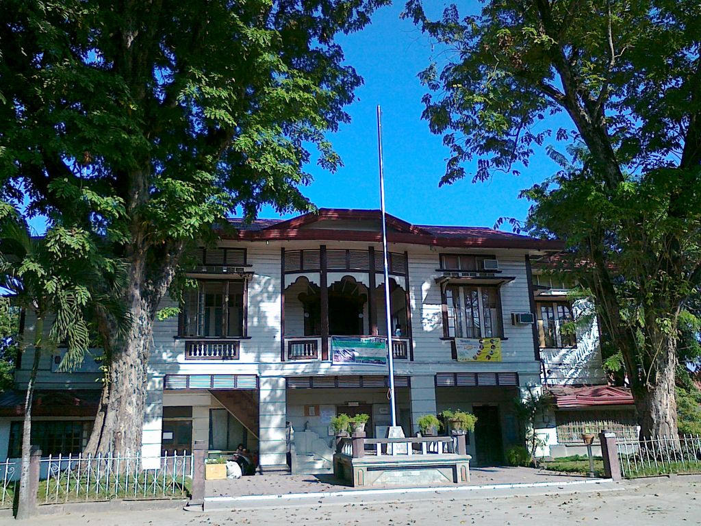
Initao, officially the Municipality of Initao (Cebuano: Lungsod sa Initao; Tagalog: Bayan ng Initao), is a 3rd class municipality in the province of Misamis Oriental, Philippines. According to the 2020 census, it has a population of 33,902 people. It is seated about 39 kilometres (24 mi) west of the provincial capital of Cagayan de Oro, 29 kilometres (18 mi) east of Iligan City, and about 767 kilometres (477 mi) south-south-east of Philippine capital, Manila. The nearest primary road network is the Butuan–Cagayan de Oro–Iligan Road. The nearest airport is Laguindingan International Airport located 39 minutes away towards Cagayan de Oro. HazardHunterPh app assessment on seismic hazard marks the town safe from ground rupture, prone to ground shaking and generally susceptible to liquefaction. Volcanic Hazard assessment mainly identifies it as having no immediate volcanic hazard threat base on its location to the nearest active volcano. However, it has high susceptibility to flooding at 1 to 2 meters flood height and lasting for more than 3 days. Economic activity in the area is mainly dependent on fishing, agriculture, retail, tourism and government services such as The Misamis Oriental Provincial Hospital-Initao, Regional Trial Court Branch 44, Initao-Libertad 8th Municipal Circuit Trial Court, Initao College, the BJMP, DENR, DepEd etc. According to the Bureau of Local Government Finance, the annual regular revenue of Initao for the fiscal year of 2016 was ₱98,017,030.37. Tourism sites include the Initao-Libertad Protected Landscape and Seascape which locals simply call "lasang" or forest in the local dialect, various beaches dotting its shorelines and recent additions of agritourism sites developed by locals. Significant town celebrations include the town fiesta celebrated by Roman Catholics in honor of the Patron Saint Francis Xavier which is held every December 2 and 3 although the celebration stretches for a week. Various festivals promoting tourism are also being spearheaded by the LGU and the Provincial Government of Misamis Oriental.
Show more
Sun and Moon
Mon
Tue
Wed
Thu
Fri
Sat
Sun
May 2022
Date and time
00:00
06:00
12:00
18:00
Today
--
--
Sunrise
--
Sunset
--
Moonrise
--
Moonset
Phase
🌔 Waxing Gibbous
The perfect light time for beautiful photos:
--
Sunrise
--
Sunset
PeakVisor app
Get the app on your smartphone
New Panorama Tools
Trace location on the map
Measure distances
All the instruments are available in the context menu as well.
We use GPS information embedded into the photo when it is available.
3D mountains overlay
Adjust mountain panorama to perfectly match your photos because recorded by camera photo position might be imprecise.
Move tool
Rotate tool
Zoom
More customization
Choose which peak labels should make into the final photo and what photo title should be.
Next
Photo Location
Satellitte
Flat map
Relief map
Latitude
Longitude
Altitude
OR
Latitude
°'''
Longitude
°'''
Apply
Register Peak
Peak Name
Latitude
Longitude
Altitude
Register
Teleport
PeakVisor
This 3D model of Sagarmatha National Park in Nepal was made using the PeakVisor app topographic data. The mobile app features higher precision models worldwide, more topographic details, and works offline. Download PeakVisor maps today.
Download OBJ model
PeakVisor
The download should start shortly. If you find it useful please consider supporting the PeakVisor app.
PeakVisor for iOS and Android
Be a superhero of outdoor navigation with state-of-the-art 3D maps and mountain identification in the palm of your hand!