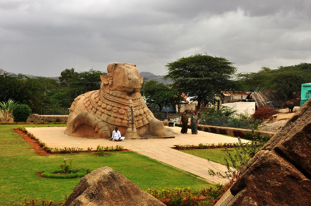
Hindupuram is a city in Sri Sathya Sai district of the Indian state of Andhra Pradesh. It is located to the edge of the Andhra–Karnataka border and is the headquarters of Hindupuram mandalam. Hindupuram is the Parliamentary Constituency in the newly formed District Sri Sathya Sai. It is located about 67 km from district headquarters Puttaparthi, 100 km from Bengaluru the capital of Karnataka, 95 km From Kadiri. As of 2011, Hindupuram municipality had a population of 151,835. It is an important local pilgrimage center with a number of temples in and around the city, including Sri Peta Venkata Ramana Swamy Temple, Sree Vasavi Kanyaka Parameshwari Temple, Guddam Sri Ranganath Swamy Temple, Sugur Sri Anjaneya Swamy Temple, and the historical Lepakshi Sri Veerabhadra Swamy Temple. Hindupuram is connected with the major cities in the region by road and by train. This includes National Highway 44, Bangalore Highway [KA SH 9], Parigi Road, Lepakshi Road National Highway 544E (India), Kadiri Road National Highway 716G (India), and Penukonda Road. Hindupur Railway Station (code – 'HUP') in the Bengaluru City Railway Station KSR Bengaluru stretch of the South Western Railway zone is one of the busiest in the route. The Penukonda–Hindupur and Hindupur Industrial Area maintained by Andhra Pradesh Industrial Infrastructure Corporation and Hindupur's surrounding stretch has a number of industries involved in manufacturing, pharmaceutical, automobile and IT which makes Hindupur as industrial town in State.
Show more
Sun and Moon
Mon
Tue
Wed
Thu
Fri
Sat
Sun
May 2022
Date and time
00:00
06:00
12:00
18:00
Today
--
--
Sunrise
--
Sunset
--
Moonrise
--
Moonset
Phase
🌔 Waxing Gibbous
The perfect light time for beautiful photos:
--
Sunrise
--
Sunset
PeakVisor app
Get the app on your smartphone
New Panorama Tools
Trace location on the map
Measure distances
All the instruments are available in the context menu as well.
We use GPS information embedded into the photo when it is available.
3D mountains overlay
Adjust mountain panorama to perfectly match your photos because recorded by camera photo position might be imprecise.
Move tool
Rotate tool
Zoom
More customization
Choose which peak labels should make into the final photo and what photo title should be.
Next
Photo Location
Satellitte
Flat map
Relief map
Latitude
Longitude
Altitude
OR
Latitude
°'''
Longitude
°'''
Apply
Register Peak
Peak Name
Latitude
Longitude
Altitude
Register
Teleport
PeakVisor
This 3D model of Sagarmatha National Park in Nepal was made using the PeakVisor app topographic data. The mobile app features higher precision models worldwide, more topographic details, and works offline. Download PeakVisor maps today.
Download OBJ model
PeakVisor
The download should start shortly. If you find it useful please consider supporting the PeakVisor app.
PeakVisor for iOS and Android
Be a superhero of outdoor navigation with state-of-the-art 3D maps and mountain identification in the palm of your hand!