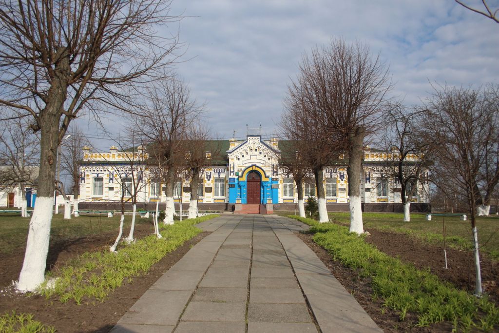
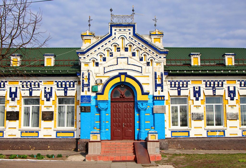
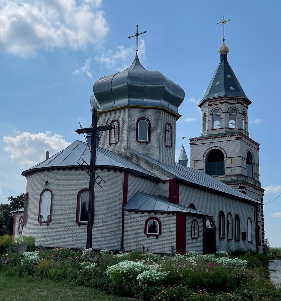
Hermanivka (Ukrainian: Германівка) is a village (selo) in Obukhiv Raion (district), Kyiv Oblast, south of Kyiv, in central Ukraine. It belongs to Obukhiv urban hromada, one of the hromadas of Ukraine. The Chervona River flows through the town on its way to confluence with the Dnieper. Hermanivka's history extends back some 900 years. Hermanivka has a small museum opened in 1995 which contains more than 4,000 exhibits related to the history of the town, with substantial coverage of its involvement with the Zaporizhian Cossacks. Cossack Hetman and Ukrainian national hero Bohdan Khmelnytsky twice battled Polish–Lithuanian Commonwealth forces at Hermanivka in 1651. A few years later, in 1658, the Hadiach Treaty between the Cossacks and Poles was declared in Hermanivka by Cossack Hetman Ivan Vyhovsky. A famous Cossack leader Severyn Nalyvaiko twice visited Hermanivka in the 1590s. Two Cossack colonels – Prokop Vereshchak and Stepan Sulyma – are buried in Hermanivka. In the 18th century, peasants of Hermanivka, by then a part of the Russian Empire, participated actively in the anti-serfdom movement. Hermanivka suffered greatly during the Holodomor famine of 1932–33, losing 20 percent of its population. At present Hermanivka has 890 households, several schools, libraries and churches.
Show more
Sun and Moon
Mon
Tue
Wed
Thu
Fri
Sat
Sun
May 2022
Date and time
00:00
06:00
12:00
18:00
Today
--
--
Sunrise
--
Sunset
--
Moonrise
--
Moonset
Phase
🌔 Waxing Gibbous
The perfect light time for beautiful photos:
--
Sunrise
--
Sunset
PeakVisor app
Get the app on your smartphone
New Panorama Tools
Trace location on the map
Measure distances
All the instruments are available in the context menu as well.
We use GPS information embedded into the photo when it is available.
3D mountains overlay
Adjust mountain panorama to perfectly match your photos because recorded by camera photo position might be imprecise.
Move tool
Rotate tool
Zoom
More customization
Choose which peak labels should make into the final photo and what photo title should be.
Next
Photo Location
Satellitte
Flat map
Relief map
Latitude
Longitude
Altitude
OR
Latitude
°'''
Longitude
°'''
Apply
Register Peak
Peak Name
Latitude
Longitude
Altitude
Register
Teleport
PeakVisor
This 3D model of Sagarmatha National Park in Nepal was made using the PeakVisor app topographic data. The mobile app features higher precision models worldwide, more topographic details, and works offline. Download PeakVisor maps today.
Download OBJ model
PeakVisor
The download should start shortly. If you find it useful please consider supporting the PeakVisor app.
PeakVisor for iOS and Android
Be a superhero of outdoor navigation with state-of-the-art 3D maps and mountain identification in the palm of your hand!