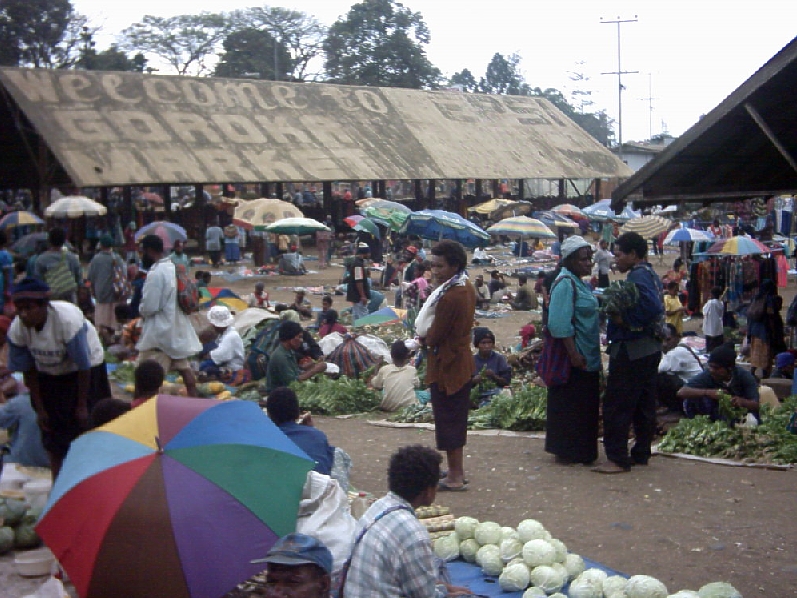
Goroka is the capital of the Eastern Highlands Province of Papua New Guinea. It is a town of approximately 19,000 people (2000), 1,600 meters (5,200 feet) above sea level. It has an airport (in the centre of town) and is on the "Highlands Highway", about 285 km (177 mi) from Lae in Morobe province and 90 km (56 mi) from the nearby town of Kainantu also in the Eastern Highlands. Other nearby towns include Kundiawa in Simbu Province and Mount Hagen in Western Highlands Province. It has a mild climate, known as a "perpetual Spring". It is the home of several national institutions: CRMF Christian Radio Missionary Fellowship, the PNG Institute of Medical Research, the National Film Institute, the Liturgical Catechetical Institute, the Melanesian Institute, the Raun Raun Theatre Company and the University of Goroka. Several NGOs also have presences there, including Oxfam and Save the Children. The town's single largest hotel is the Bird of Paradise, owned by the Coral Seas Hotels chain. Coffee is a common cash crop in the area; smaller industries include trout farms, pigs, bee keeping and food gardens (broccoli, kau kau or sweet potato, carrots, ginger and peanuts are examples of produce that grow well here; nearby Bena Bena is known for its pineapples).
Show more
Sun and Moon
Mon
Tue
Wed
Thu
Fri
Sat
Sun
May 2022
Date and time
00:00
06:00
12:00
18:00
Today
--
--
Sunrise
--
Sunset
--
Moonrise
--
Moonset
Phase
🌔 Waxing Gibbous
The perfect light time for beautiful photos:
--
Sunrise
--
Sunset
PeakVisor app
Get the app on your smartphone
New Panorama Tools
Trace location on the map
Measure distances
All the instruments are available in the context menu as well.
We use GPS information embedded into the photo when it is available.
3D mountains overlay
Adjust mountain panorama to perfectly match your photos because recorded by camera photo position might be imprecise.
Move tool
Rotate tool
Zoom
More customization
Choose which peak labels should make into the final photo and what photo title should be.
Next
Photo Location
Satellitte
Flat map
Relief map
Latitude
Longitude
Altitude
OR
Latitude
°'''
Longitude
°'''
Apply
Register Peak
Peak Name
Latitude
Longitude
Altitude
Register
Teleport
PeakVisor
This 3D model of Sagarmatha National Park in Nepal was made using the PeakVisor app topographic data. The mobile app features higher precision models worldwide, more topographic details, and works offline. Download PeakVisor maps today.
Download OBJ model
PeakVisor
The download should start shortly. If you find it useful please consider supporting the PeakVisor app.
PeakVisor for iOS and Android
Be a superhero of outdoor navigation with state-of-the-art 3D maps and mountain identification in the palm of your hand!