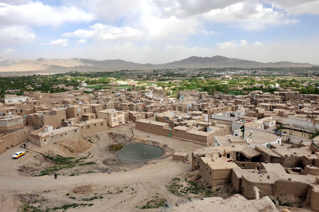
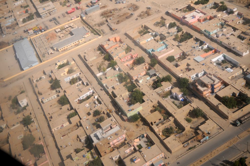
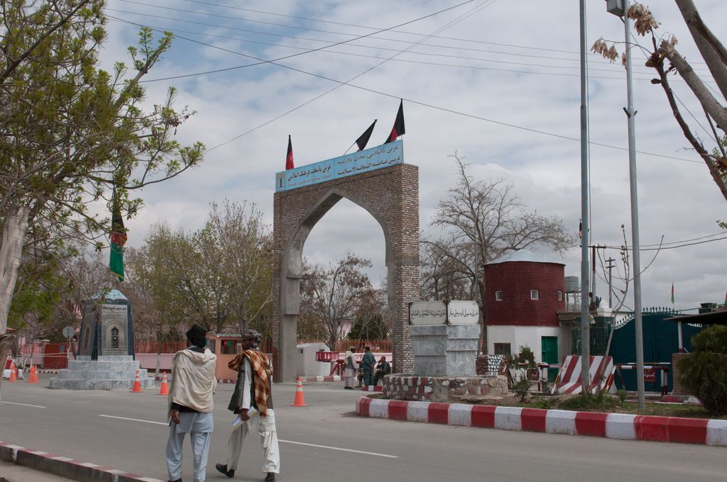
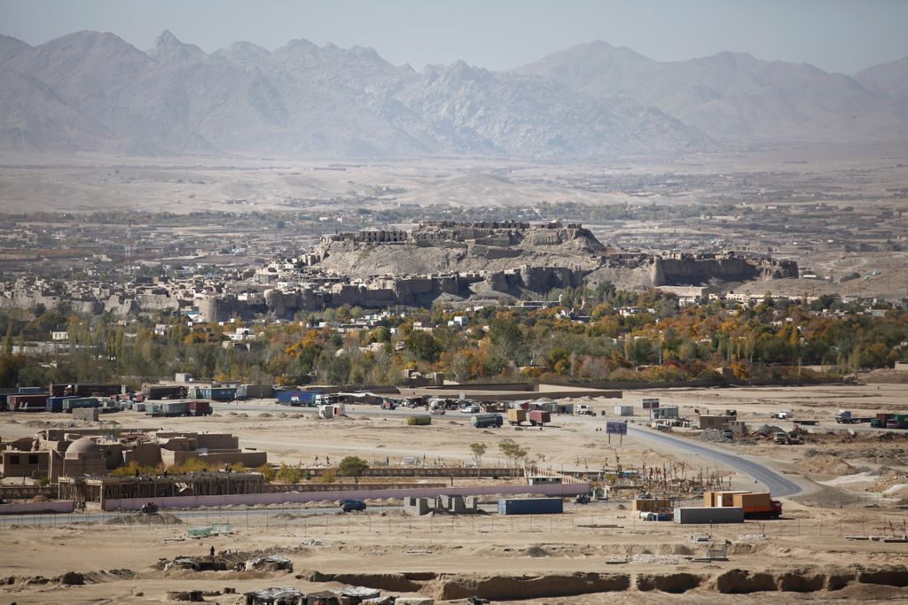
Ghazni (Dari: غزنی, Pashto: غزني), historically known as Ghaznayn (غزنين) or Ghazna (غزنه), also transliterated as Ghuznee, and anciently known as Alexandria in Opiana (Greek: Αλεξάνδρεια Ωπιανή), is a city in southeastern Afghanistan with a population of around 190,000 people. The city is strategically located along Highway 1, which has served as the main road between Kabul and Kandahar for thousands of years. Situated on a plateau at 2,219 metres (7,280 ft) above sea level, the city is 150 kilometres (93 mi) south of Kabul and is the capital of Ghazni Province. The name Ghazni drives from the Persian word "ganj", meaning ‘treasure’. Ghazni Citadel, the Minarets of Ghazni, the Palace of Sultan Mas'ud III, and several other cultural heritage sites have brought travelers and archeologists to the city for centuries. During the pre-Islamic period, the area was inhabited by various tribes who practiced different religions including Zoroastrianism, Buddhism and Hinduism. Arab Muslims introduced Islam to Ghazni in the 7th century and were followed in the 9th century by the Saffarids. Sabuktigin made Ghazni the capital of the Ghaznavid Empire in the 10th century. The city was destroyed by one of the Ghurid rulers but later rebuilt. It fell to several regional powers, including the Timurids and the Delhi Sultanate until it became part of the Hotaki dynasty, which was followed by the Durrani Empire or modern Afghanistan. During the First Anglo-Afghan War in the 19th century, the fortifications of Ghazni were partially demolished by British Indian forces. In August 2018, the city became the site of the Battle of Ghazni with the Taliban briefly occupying it and taking control of most of the surrounding area. On 12 August 2021, the city was captured by the Taliban as part of the 2021 Taliban offensive. In 2013, ISESCO declared Ghazni the year's Islamic Capital of Culture.
Show more
Sun and Moon
Mon
Tue
Wed
Thu
Fri
Sat
Sun
May 2022
Date and time
00:00
06:00
12:00
18:00
Today
--
--
Sunrise
--
Sunset
--
Moonrise
--
Moonset
Phase
🌔 Waxing Gibbous
The perfect light time for beautiful photos:
--
Sunrise
--
Sunset
PeakVisor app
Get the app on your smartphone
New Panorama Tools
Trace location on the map
Measure distances
All the instruments are available in the context menu as well.
We use GPS information embedded into the photo when it is available.
3D mountains overlay
Adjust mountain panorama to perfectly match your photos because recorded by camera photo position might be imprecise.
Move tool
Rotate tool
Zoom
More customization
Choose which peak labels should make into the final photo and what photo title should be.
Next
Photo Location
Satellitte
Flat map
Relief map
Latitude
Longitude
Altitude
OR
Latitude
°'''
Longitude
°'''
Apply
Register Peak
Peak Name
Latitude
Longitude
Altitude
Register
Teleport
PeakVisor
This 3D model of Sagarmatha National Park in Nepal was made using the PeakVisor app topographic data. The mobile app features higher precision models worldwide, more topographic details, and works offline. Download PeakVisor maps today.
Download OBJ model
PeakVisor
The download should start shortly. If you find it useful please consider supporting the PeakVisor app.
PeakVisor for iOS and Android
Be a superhero of outdoor navigation with state-of-the-art 3D maps and mountain identification in the palm of your hand!