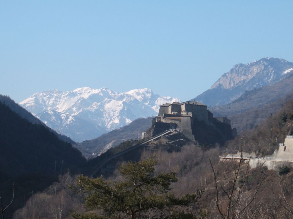
The Exilles Fort (Italian: Forte di Exilles [ˈfɔrte di eˈksil, - eˈɡzil]; French: Fort d'Exilles [fɔʁ dɛɡzil]) is a fortified complex in the Susa Valley, Metropolitan City of Turin, Piedmont, northern Italy. Together with the nearby Fort of Fenestrelle and the Forte Albertino (at Vinadio, in the province of Cuneo) it was part of the defensive line between the House of Savoy lands (later of the Kingdom of Italy) and France: both these states held it in different phases depending on the outcome of the various wars. It is located on a spur commanding one of the narrowest sections of the Susa Valley, along the main road connecting Turin to France.
We use GPS information embedded into the photo when it is available.
3D mountains overlay
Adjust mountain panorama to perfectly match your photos because recorded by camera photo position might be imprecise.
Move tool
Rotate tool
Zoom
More customization
Choose which peak labels should make into the final photo and what photo title should be.
Next
Photo Location
Satellitte
Flat map
Relief map
Latitude
Longitude
Altitude
OR
Latitude
°'''
Longitude
°'''
Apply
Register Peak
Peak Name
Latitude
Longitude
Altitude
Register
Teleport
PeakVisor
This 3D model of Sagarmatha National Park in Nepal was made using the PeakVisor app topographic data. The mobile app features higher precision models worldwide, more topographic details, and works offline. Download PeakVisor maps today.
Download OBJ model
PeakVisor
The download should start shortly. If you find it useful please consider supporting the PeakVisor app.
PeakVisor for iOS and Android
Be a superhero of outdoor navigation with state-of-the-art 3D maps and mountain identification in the palm of your hand!