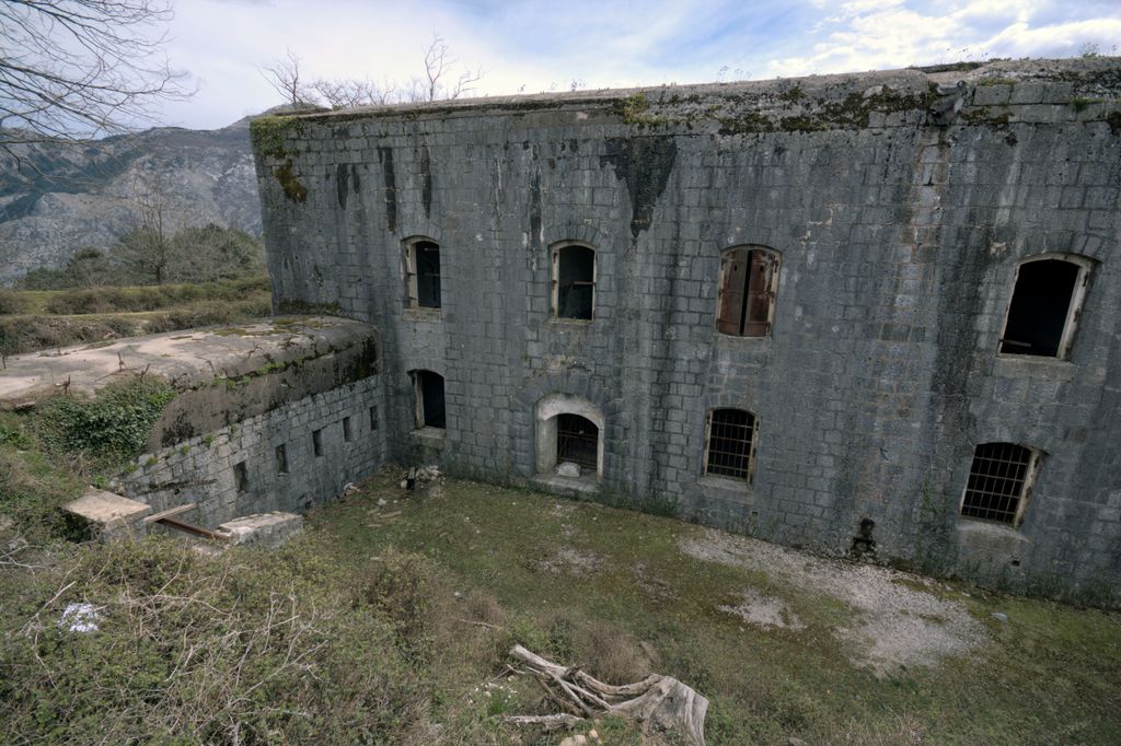
Fort Vrmac (Montenegrin: Tvrđava Vrmac/Тврђава Врмац, German: Werk Vermac) is a former fortification of the Austro-Hungarian Empire located on the southern end of the Vrmac ridge near Tivat in Montenegro. Established in 1860, the present structure was built between 1894 and 1897, and saw action during the First World War, when it was heavily bombarded by the Montenegrins. It was repaired and disarmed before the end of the war and was abandoned after a period of occupation by Yugoslav troops. Today it is one of the best preserved Austro-Hungarian fortifications in the Bay of Kotor area.
We use GPS information embedded into the photo when it is available.
3D mountains overlay
Adjust mountain panorama to perfectly match your photos because recorded by camera photo position might be imprecise.
Move tool
Rotate tool
Zoom
More customization
Choose which peak labels should make into the final photo and what photo title should be.
Next
Photo Location
Satellitte
Flat map
Relief map
Latitude
Longitude
Altitude
OR
Latitude
°'''
Longitude
°'''
Apply
Register Peak
Peak Name
Latitude
Longitude
Altitude
Register
Teleport
PeakVisor
This 3D model of Sagarmatha National Park in Nepal was made using the PeakVisor app topographic data. The mobile app features higher precision models worldwide, more topographic details, and works offline. Download PeakVisor maps today.
Download OBJ model
PeakVisor
The download should start shortly. If you find it useful please consider supporting the PeakVisor app.
PeakVisor for iOS and Android
Be a superhero of outdoor navigation with state-of-the-art 3D maps and mountain identification in the palm of your hand!