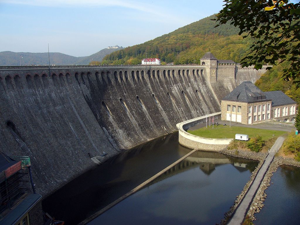
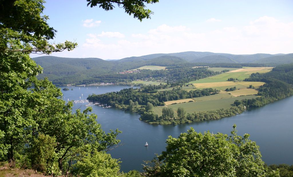
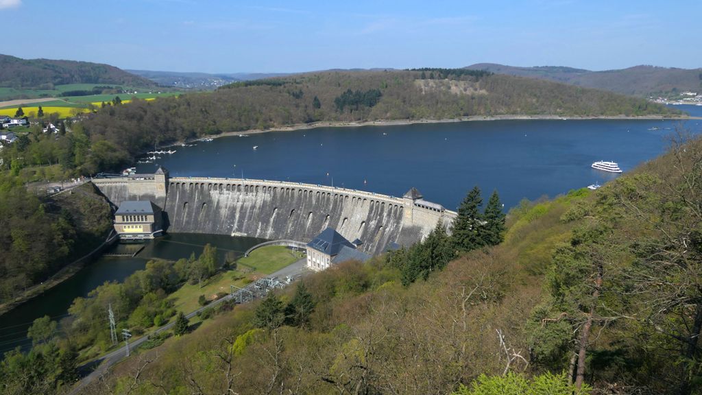
The Edersee, also known as the Ederstausee, is an 11.8 km2 (4.6 sq mi) reservoir in Waldeck-Frankenberg, Hesse, Germany holding back an estimated 199.3 million m3 (7.04 billion cu ft). It has the second-largest area (behind the Forggensee), and the third-largest volume (behind the Bleilochstausee and Rurstausee), of all reservoirs in Germany. It is on the chief western tributary of the Fulda, the Eder, behind the 48 m-high (157 ft) Edersee Dam near the town of Waldeck in the Waldeck-Frankenberg district of North Hesse. The dam and reservoir are owned by the Federal Waterways and Shipping Administration, whose Hann. Münden Waterways and Shipping office is locally responsible. The primary purpose is provision of water for the federal waterways, the Oberweser and Mittellandkanal. The dam also protects downstream residents from small and medium floods, generates electrical energy and the lake is used for sports and leisure.
Show more
Sun and Moon
Mon
Tue
Wed
Thu
Fri
Sat
Sun
May 2022
Date and time
00:00
06:00
12:00
18:00
Today
--
--
Sunrise
--
Sunset
--
Moonrise
--
Moonset
Phase
🌔 Waxing Gibbous
The perfect light time for beautiful photos:
--
Sunrise
--
Sunset
PeakVisor app
Get the app on your smartphone
New Panorama Tools
Trace location on the map
Measure distances
All the instruments are available in the context menu as well.
We use GPS information embedded into the photo when it is available.
3D mountains overlay
Adjust mountain panorama to perfectly match your photos because recorded by camera photo position might be imprecise.
Move tool
Rotate tool
Zoom
More customization
Choose which peak labels should make into the final photo and what photo title should be.
Next
Photo Location
Satellitte
Flat map
Relief map
Latitude
Longitude
Altitude
OR
Latitude
°'''
Longitude
°'''
Apply
Register Peak
Peak Name
Latitude
Longitude
Altitude
Register
Teleport
PeakVisor
This 3D model of Sagarmatha National Park in Nepal was made using the PeakVisor app topographic data. The mobile app features higher precision models worldwide, more topographic details, and works offline. Download PeakVisor maps today.
Download OBJ model
PeakVisor
The download should start shortly. If you find it useful please consider supporting the PeakVisor app.
PeakVisor for iOS and Android
Be a superhero of outdoor navigation with state-of-the-art 3D maps and mountain identification in the palm of your hand!