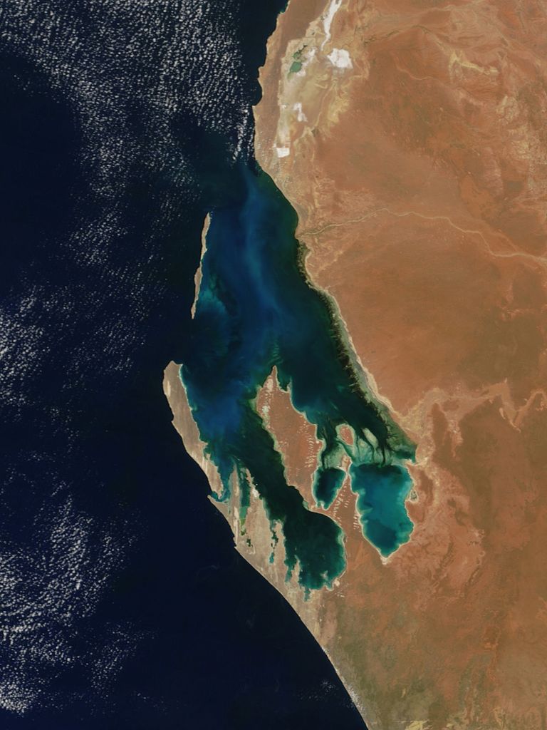
Dirk Hartog Island is an island off the Gascoyne coast of Western Australia, within the Shark Bay World Heritage Area. It is about 80 kilometres (50 miles) long and between 3 and 15 kilometres (1.9 and 9.3 miles) wide and is Western Australia's largest and most western island. It covers an area of 620 square kilometres (240 square miles) and is approximately 850 kilometres (530 miles) north of Perth. Known as Wirrumana by the traditional custodians of the island, the Malgana people, the island is named after Dirk Hartog, a Dutch sea captain, whose ship first encountered the Western Australian coastline in 1616, close to the 26th parallel south latitude, which runs through the island. After leaving the island, Hartog continued his voyage north-east along the coast, giving the Australian mainland one of its earliest known names, Eendrachtsland, which he named after his ship Eendracht, meaning "concord". The island is now the site of a major environmental reconstruction project, Return to 1616, that has seen all introduced livestock and feral animals removed, and eleven native species in various stages of reintroduction.
We use GPS information embedded into the photo when it is available.
3D mountains overlay
Adjust mountain panorama to perfectly match your photos because recorded by camera photo position might be imprecise.
Move tool
Rotate tool
Zoom
More customization
Choose which peak labels should make into the final photo and what photo title should be.
Next
Photo Location
Satellitte
Flat map
Relief map
Latitude
Longitude
Altitude
OR
Latitude
°'''
Longitude
°'''
Apply
Register Peak
Peak Name
Latitude
Longitude
Altitude
Register
Teleport
PeakVisor
This 3D model of Sagarmatha National Park in Nepal was made using the PeakVisor app topographic data. The mobile app features higher precision models worldwide, more topographic details, and works offline. Download PeakVisor maps today.
Download OBJ model
PeakVisor
The download should start shortly. If you find it useful please consider supporting the PeakVisor app.
PeakVisor for iOS and Android
Be a superhero of outdoor navigation with state-of-the-art 3D maps and mountain identification in the palm of your hand!