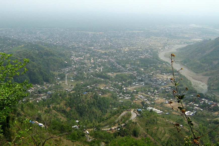
Dharan (Nepali: धरान) is a sub-metropolitan city in Sunsari District of Koshi Province, in eastern Nepal, which was established as a fourth municipality in the Kingdom in 1958. It is the third most populous city in eastern Nepal after Biratnagar and Itahari. The Nepali word "dharan" means a saw pit. The rainforest from which the tree trunks came is still just on the edge of the city. Much later the British Gurkha camp opened in October 1960. The use of the camp by British Gurkhas finished in the mid-1990s. Dharan has an estimated city population of 173,096 living in 34,834 households as per the 2021 Nepal census. It is one of the cities of the Greater Birat Development Area which incorporates the cities of Biratnagar-Itahari-Gothgau-Biratchowk-Dharan primarily located on the Koshi Highway in Eastern Nepal, with an estimated total urban agglomerated population of 804,300 people living in 159,332 households. It is the largest city in the province number one by Area. It covers 192.32 square kilometers while Biratnagar and Itahari is 2nd and 3rd biggest cities by Area
We use GPS information embedded into the photo when it is available.
3D mountains overlay
Adjust mountain panorama to perfectly match your photos because recorded by camera photo position might be imprecise.
Move tool
Rotate tool
Zoom
More customization
Choose which peak labels should make into the final photo and what photo title should be.
Next
Photo Location
Satellitte
Flat map
Relief map
Latitude
Longitude
Altitude
OR
Latitude
°'''
Longitude
°'''
Apply
Register Peak
Peak Name
Latitude
Longitude
Altitude
Register
Teleport
PeakVisor
This 3D model of Sagarmatha National Park in Nepal was made using the PeakVisor app topographic data. The mobile app features higher precision models worldwide, more topographic details, and works offline. Download PeakVisor maps today.
Download OBJ model
PeakVisor
The download should start shortly. If you find it useful please consider supporting the PeakVisor app.
PeakVisor for iOS and Android
Be a superhero of outdoor navigation with state-of-the-art 3D maps and mountain identification in the palm of your hand!