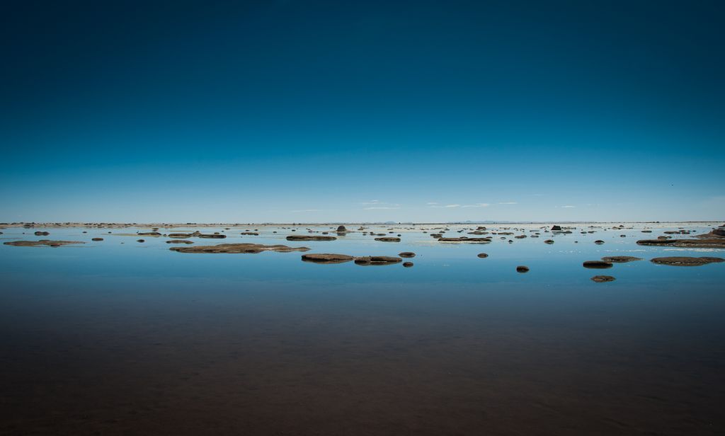
Lago Coipasa or Salar de Coipasa is a lake in Sabaya Province, Oruro Department, Bolivia. At an elevation of 3657 m, its surface area is 806 km². It is on the western part of Altiplano, 20 km north of Salar de Uyuni and south of the main road linking Oruro and Huara (Chile). Lake Coipasa is a tectonic saline lake with a depth of 3.5 metres that is surrounded by the Coipasa salt flat (Salar de Coipasa), and the volcanic cone of the 4,920 m high Wila Pukarani. Thousands of flamingos have settled on the shores of Lake Coipasa.
We use GPS information embedded into the photo when it is available.
3D mountains overlay
Adjust mountain panorama to perfectly match your photos because recorded by camera photo position might be imprecise.
Move tool
Rotate tool
Zoom
More customization
Choose which peak labels should make into the final photo and what photo title should be.
Next
Photo Location
Satellitte
Flat map
Relief map
Latitude
Longitude
Altitude
OR
Latitude
°'''
Longitude
°'''
Apply
Register Peak
Peak Name
Latitude
Longitude
Altitude
Register
Teleport
PeakVisor
This 3D model of Sagarmatha National Park in Nepal was made using the PeakVisor app topographic data. The mobile app features higher precision models worldwide, more topographic details, and works offline. Download PeakVisor maps today.
Download OBJ model
PeakVisor
The download should start shortly. If you find it useful please consider supporting the PeakVisor app.
PeakVisor for iOS and Android
Be a superhero of outdoor navigation with state-of-the-art 3D maps and mountain identification in the palm of your hand!