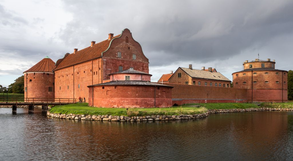
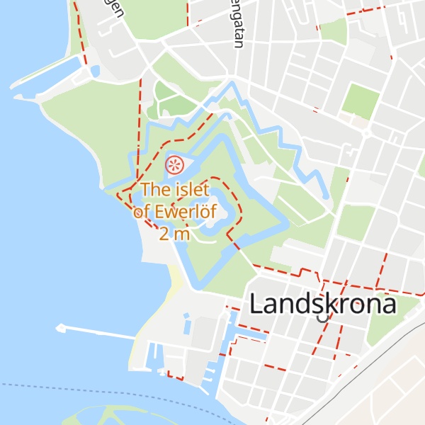
Landskrona Citadel (Swedish: Citadellet or Landskrona slott) is situated in Landskrona, Scania, southern Sweden. Much of the original work is intact. Examples remain of all major parts of the fortification, which is uncommon in such an accessible area. The moat around the central fortification is intact, as are the north-west and north-east parts of the outermost moat, which originally connected to a moat surrounding the city itself. Centermost, the citadel sits on an island surrounded by its own moat. North of the fort, between the second, third and fourth moat is Sweden's oldest allotment-garden. Several of its garden houses are attractions in themselves. Also the fortress castle itself hides both history as such as well as historical horrors, like the 16th Century dungeon in the old western tower, into which the unlucky prisoners were thrown down through a hatch. If surviving the 4-5 meter fall, there then was neither any daylight or any way out. Also the eastern tower has in later centuries served as a prison for those serving life sentences. Around 1900 until 1940 a part of the fortress served as a forced labour institution for vagrant women
Show more
Sun and Moon
Mon
Tue
Wed
Thu
Fri
Sat
Sun
May 2022
Date and time
00:00
06:00
12:00
18:00
Today
--
--
Sunrise
--
Sunset
--
Moonrise
--
Moonset
Phase
🌔 Waxing Gibbous
The perfect light time for beautiful photos:
--
Sunrise
--
Sunset
PeakVisor app
Get the app on your smartphone
New Panorama Tools
Trace location on the map
Measure distances
All the instruments are available in the context menu as well.
We use GPS information embedded into the photo when it is available.
3D mountains overlay
Adjust mountain panorama to perfectly match your photos because recorded by camera photo position might be imprecise.
Move tool
Rotate tool
Zoom
More customization
Choose which peak labels should make into the final photo and what photo title should be.
Next
Photo Location
Satellitte
Flat map
Relief map
Latitude
Longitude
Altitude
OR
Latitude
°'''
Longitude
°'''
Apply
Register Peak
Peak Name
Latitude
Longitude
Altitude
Register
Teleport
PeakVisor
This 3D model of Sagarmatha National Park in Nepal was made using the PeakVisor app topographic data. The mobile app features higher precision models worldwide, more topographic details, and works offline. Download PeakVisor maps today.
Download OBJ model
PeakVisor
The download should start shortly. If you find it useful please consider supporting the PeakVisor app.
PeakVisor for iOS and Android
Be a superhero of outdoor navigation with state-of-the-art 3D maps and mountain identification in the palm of your hand!