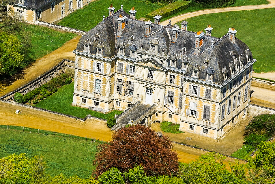
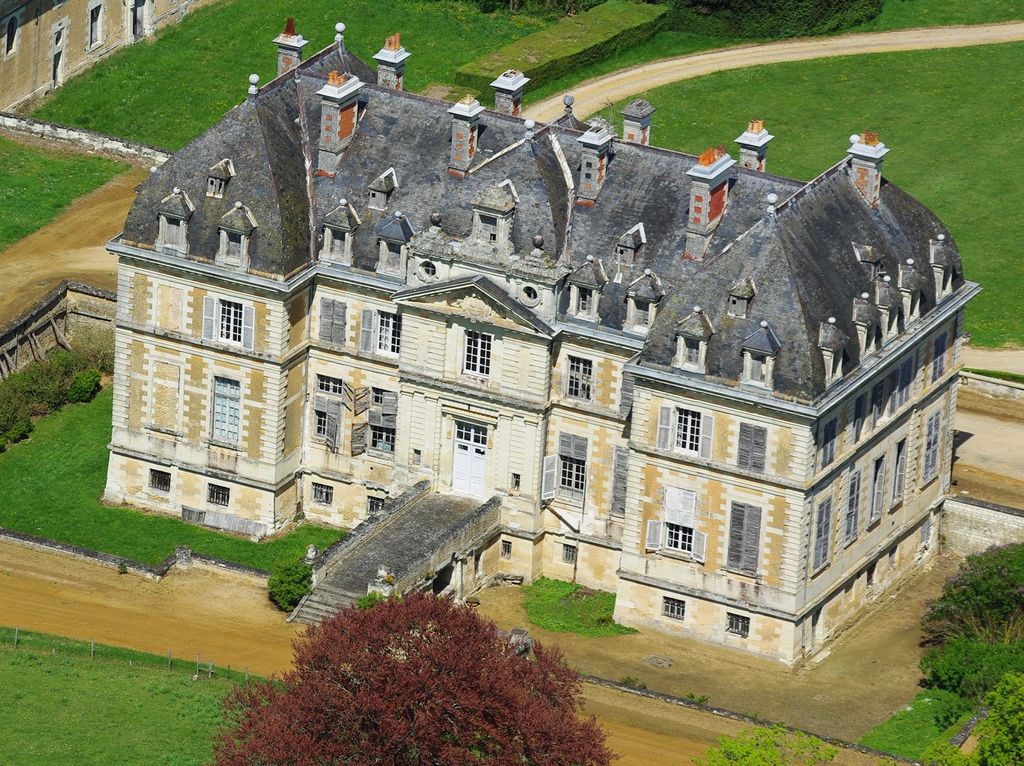
Château de Purnon is a historic French château located in the commune of Verrue in the department of Vienne. The château was constructed between 1779 and 1788 (1788) for Antoine-Charles Achard, Marquis de la Haye (1737–1816) from material reclaimed from the ruins of the nearby Château de Brisay. Constructed during the reign of Louis XVI the château was completed just prior to the commencement of the French Revolution. The château is flanked by two enormous outbuildings featuring rare charpente in the style of Philibert de l'Orme. A 3 km (1.9 mi) grand allée traverses the Forêt de Scévolles from the north of the domain. In 1893, Purnon was purchased by Daniel Jérôme Robineau de Rochequairie, Marquis de Rochequairie (1856–1919). His descendants sold the estate to its current owners in 2020. The château and the two main outbuildings, the dry moat, the terraces and the northern entrance gate were all classified as Historical Monuments on May 10, 1995. The Moulin Bijard, the potager garden and pavilion, the rare Eolienne Bollée and its reservoir were listed as Historic Monuments on December 11, 1992 In 2019 the château was purchased by former Australian politician Tim Holding and his fiancée Felicity Selkirk, who are currently undertaking a full restoration of the domain. In 2022 Château de Purnon was awarded the Mission Bern. The Mission Bern is a national award created in 2018 to support the protection of important French heritage. Their journey to restore Château de Purnon has been documented in a book called Château Reawakening written by Tim Holding and published by Hardie Grant in 2023.
We use GPS information embedded into the photo when it is available.
3D mountains overlay
Adjust mountain panorama to perfectly match your photos because recorded by camera photo position might be imprecise.
Move tool
Rotate tool
Zoom
More customization
Choose which peak labels should make into the final photo and what photo title should be.
Next
Photo Location
Satellitte
Flat map
Relief map
Latitude
Longitude
Altitude
OR
Latitude
°'''
Longitude
°'''
Apply
Register Peak
Peak Name
Latitude
Longitude
Altitude
Register
Teleport
PeakVisor
This 3D model of Sagarmatha National Park in Nepal was made using the PeakVisor app topographic data. The mobile app features higher precision models worldwide, more topographic details, and works offline. Download PeakVisor maps today.
Download OBJ model
PeakVisor
The download should start shortly. If you find it useful please consider supporting the PeakVisor app.
PeakVisor for iOS and Android
Be a superhero of outdoor navigation with state-of-the-art 3D maps and mountain identification in the palm of your hand!