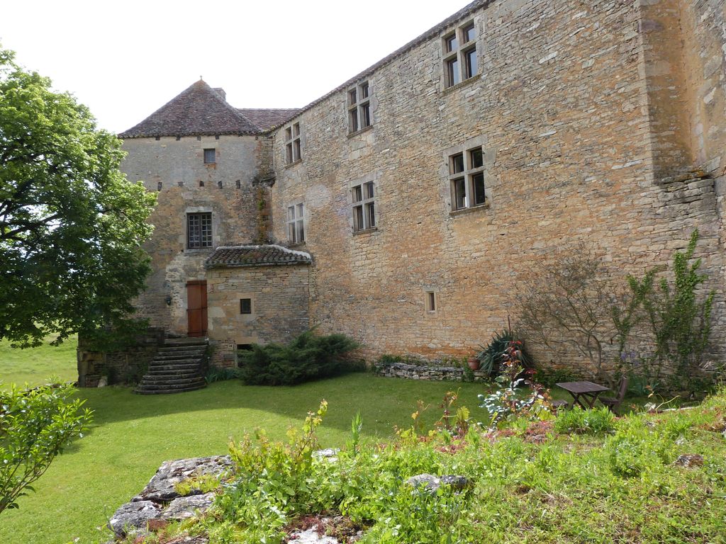
The Château de Labastide, also known as the Château de Marsa, is a castle in the commune of Beauregard in the Lot département of France. Construction dates from the 13th, 15th and 17th centuries. The Château de Labastide is made up of a main building with two wings forming, with the central building, obtuse angles. The ordered and rectangular plan suggests that the whole edifice dates from the 17th century. Certain parts, however, are older. The square tower which flanks the building to the north east dates from the 13th century. The south east gateway has traces of machicolations which date from the 15th century. Internally, little remains of the original decor. The first floor of the central part is a single room of vast proportions which still has traces of frescoes, a stone floor as well as a plafond à la française (French-style ceiling: joists the same width as the spaces between them; see Plafond à la française in French Wikipedia). The castle is privately owned. It has been listed since 1979 as a monument historique by the French Ministry of Culture.
We use GPS information embedded into the photo when it is available.
3D mountains overlay
Adjust mountain panorama to perfectly match your photos because recorded by camera photo position might be imprecise.
Move tool
Rotate tool
Zoom
More customization
Choose which peak labels should make into the final photo and what photo title should be.
Next
Photo Location
Satellitte
Flat map
Relief map
Latitude
Longitude
Altitude
OR
Latitude
°'''
Longitude
°'''
Apply
Register Peak
Peak Name
Latitude
Longitude
Altitude
Register
Teleport
PeakVisor
This 3D model of Sagarmatha National Park in Nepal was made using the PeakVisor app topographic data. The mobile app features higher precision models worldwide, more topographic details, and works offline. Download PeakVisor maps today.
Download OBJ model
PeakVisor
The download should start shortly. If you find it useful please consider supporting the PeakVisor app.
PeakVisor for iOS and Android
Be a superhero of outdoor navigation with state-of-the-art 3D maps and mountain identification in the palm of your hand!