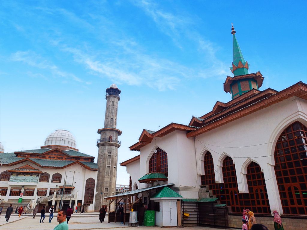
Charar-i-Sharief (variously spelled Chrar-e-Sharif, Charari Shareef, etc.) (Urdu pronunciation: [t͡ʃəɾɑːɾeː ʃəɾɪf], known as Tsrar-i-Sharif (Kashmiri pronunciation: [t͡sraːri ʃəriːf]) in Kashmiri (or colloquially as Tsrar) is a town and a notified area committee in the Budgam district of the union territory of Jammu and Kashmir, India. Charar-i-sharief Assembly constituency is one of the 90 constituencies in Jammu and Kashmir. The town was given the status of block in January 2014. The town is divided into 10 wards. Each ward has a municipal councillor. The famous mohallas of Charar-i-Sharief are: Talab-e-Kalan or Bada Talab, Trajibal, Court Road, Gulshan Abad, Nowhar, Baghi Noor U Din Nowhar, Jabl-e-Noor, Wazabagh, Alamdar colony, Zaloosa and Kumar Mohalla. Charar-i-Sharief is considered one of the most sacrosanct Muslim shrines in Kashmir. It is situated approximately 28 km (17 mi) from Srinagar, en route to Yusmarg. The Shrine of Charar-i-Sharief is approximately 600 years old. It is popularly known as the resting place of "Sheikh Noor-ud-Din Wali".
We use GPS information embedded into the photo when it is available.
3D mountains overlay
Adjust mountain panorama to perfectly match your photos because recorded by camera photo position might be imprecise.
Move tool
Rotate tool
Zoom
More customization
Choose which peak labels should make into the final photo and what photo title should be.
Next
Photo Location
Satellitte
Flat map
Relief map
Latitude
Longitude
Altitude
OR
Latitude
°'''
Longitude
°'''
Apply
Register Peak
Peak Name
Latitude
Longitude
Altitude
Register
Teleport
PeakVisor
This 3D model of Sagarmatha National Park in Nepal was made using the PeakVisor app topographic data. The mobile app features higher precision models worldwide, more topographic details, and works offline. Download PeakVisor maps today.
Download OBJ model
PeakVisor
The download should start shortly. If you find it useful please consider supporting the PeakVisor app.
PeakVisor for iOS and Android
Be a superhero of outdoor navigation with state-of-the-art 3D maps and mountain identification in the palm of your hand!