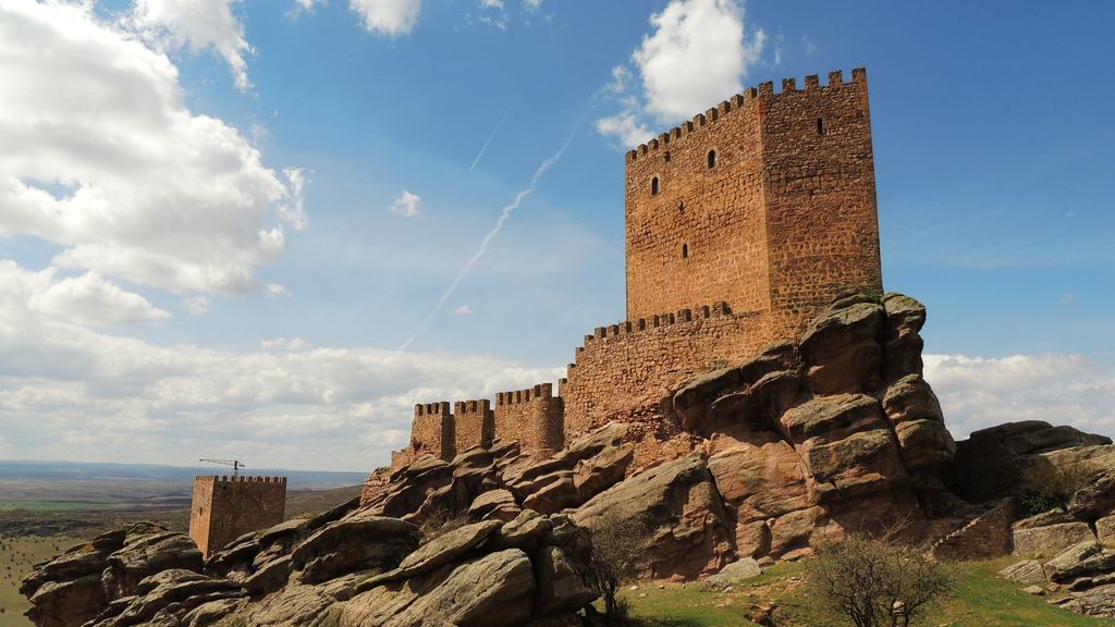
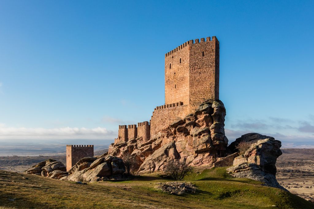
The Castle of Zafra (Spanish: Castillo de Zafra) is a 12th-century castle in the municipality of Campillo de Dueñas, in Guadalajara, Spain. Built in the late 12th or early 13th century on a sandstone outcrop in the Sierra de Caldereros, it stands on the site of a former Visigothic and Moorish fortification that fell into Christian hands in 1129. It had considerable strategic importance as a virtually impregnable defensive work on the border between Christian and Muslim-ruled territory. The castle was never conquered and was successfully defended against the King of Castile in the 13th century. The completion of the Reconquista at the end of the 15th century ended its military significance. Although it fell into ruin in the following centuries, since 1971 it has progressively been restored by its private owners. It can be visited with permission from the owners.
We use GPS information embedded into the photo when it is available.
3D mountains overlay
Adjust mountain panorama to perfectly match your photos because recorded by camera photo position might be imprecise.
Move tool
Rotate tool
Zoom
More customization
Choose which peak labels should make into the final photo and what photo title should be.
Next
Photo Location
Satellitte
Flat map
Relief map
Latitude
Longitude
Altitude
OR
Latitude
°'''
Longitude
°'''
Apply
Register Peak
Peak Name
Latitude
Longitude
Altitude
Register
Teleport
PeakVisor
This 3D model of Sagarmatha National Park in Nepal was made using the PeakVisor app topographic data. The mobile app features higher precision models worldwide, more topographic details, and works offline. Download PeakVisor maps today.
Download OBJ model
PeakVisor
The download should start shortly. If you find it useful please consider supporting the PeakVisor app.
PeakVisor for iOS and Android
Be a superhero of outdoor navigation with state-of-the-art 3D maps and mountain identification in the palm of your hand!