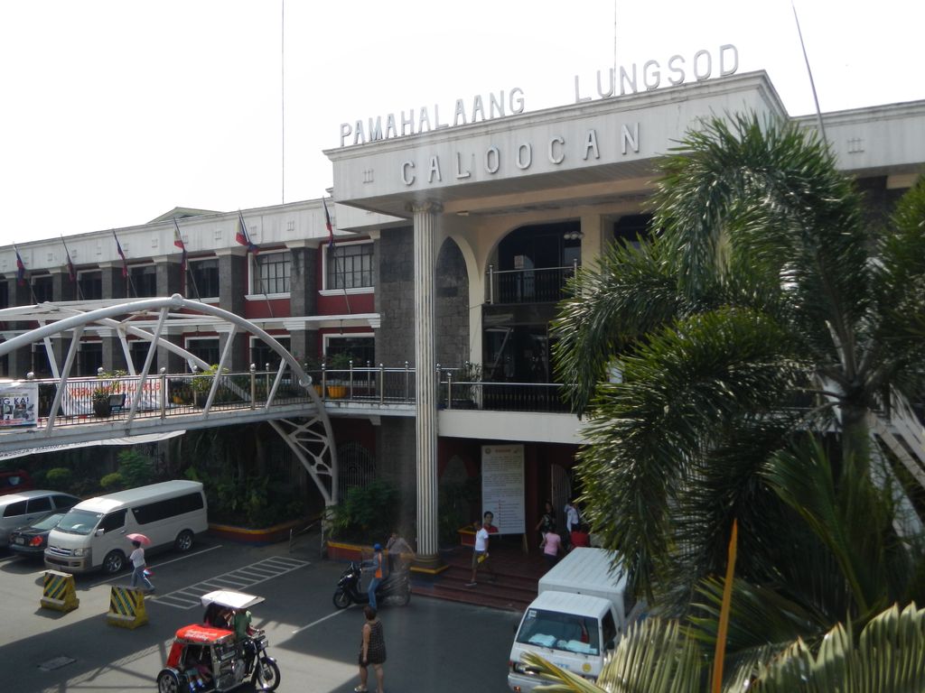
Caloocan, officially the City of Caloocan (Filipino: Lungsod ng Kalookan; IPA: [kalɔˈʔokan]), is a 1st class highly urbanized city in Metro Manila, Philippines. According to the 2020 census, it has a population of 1,661,584 people making it the fourth-most populous city in the Philippines. Caloocan is divided into two geographical locations with a total combined area of 5,333.40 hectares (13,179.1 acres), a result of the expansion of Quezon City, which absorbed much of its territory. It was formerly part of the Province of Rizal in southern Luzon. It comprises what is known as the CAMANAVA area along with the cities of Malabon, Navotas and Valenzuela. South Caloocan is bordered by Manila, Quezon City, Malabon, Navotas and Valenzuela. The presence of commercial and industrial activities combined with residential areas make it a highly urbanized central business district and a major urban center in the Northern District of Metropolitan Manila. North Caloocan shares its border with Quezon City and Valenzuela, Marilao, Meycauayan and San Jose del Monte in the province of Bulacan, and Rodriguez in the province of Rizal. It is composed of mostly residential subdivisions and extensive resettlement areas with scattered distribution of industrial estates mostly within road transit points and intersections.
Show more
Sun and Moon
Mon
Tue
Wed
Thu
Fri
Sat
Sun
May 2022
Date and time
00:00
06:00
12:00
18:00
Today
--
--
Sunrise
--
Sunset
--
Moonrise
--
Moonset
Phase
🌔 Waxing Gibbous
The perfect light time for beautiful photos:
--
Sunrise
--
Sunset
PeakVisor app
Get the app on your smartphone
New Panorama Tools
Trace location on the map
Measure distances
All the instruments are available in the context menu as well.
We use GPS information embedded into the photo when it is available.
3D mountains overlay
Adjust mountain panorama to perfectly match your photos because recorded by camera photo position might be imprecise.
Move tool
Rotate tool
Zoom
More customization
Choose which peak labels should make into the final photo and what photo title should be.
Next
Photo Location
Satellitte
Flat map
Relief map
Latitude
Longitude
Altitude
OR
Latitude
°'''
Longitude
°'''
Apply
Register Peak
Peak Name
Latitude
Longitude
Altitude
Register
Teleport
PeakVisor
This 3D model of Sagarmatha National Park in Nepal was made using the PeakVisor app topographic data. The mobile app features higher precision models worldwide, more topographic details, and works offline. Download PeakVisor maps today.
Download OBJ model
PeakVisor
The download should start shortly. If you find it useful please consider supporting the PeakVisor app.
PeakVisor for iOS and Android
Be a superhero of outdoor navigation with state-of-the-art 3D maps and mountain identification in the palm of your hand!


_01.jpg)


