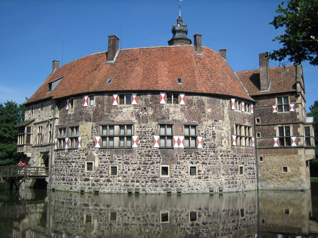
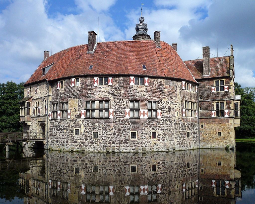
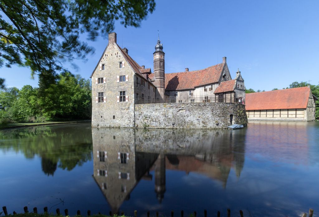
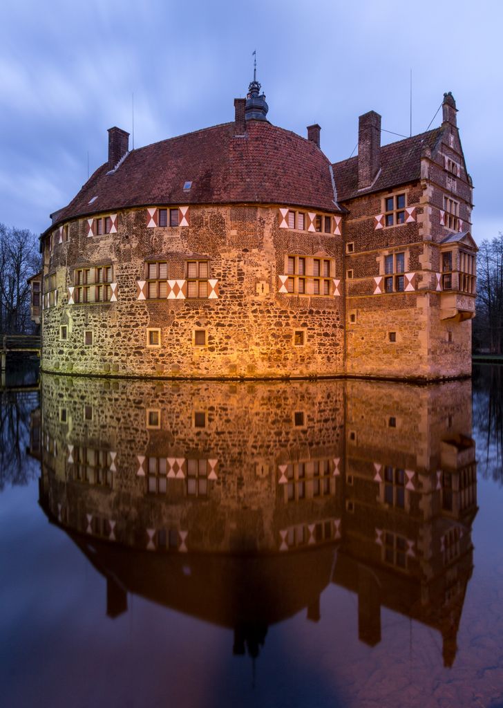
Vischering Castle (German: Burg Vischering) in Lüdinghausen, North Rhine-Westphalia is the most typical moated castle in the Münster (region) of Germany. This region has one of the highest German concentrations of castles, palaces and fortifications, Lüdinghausen having three by itself. The castle consists of outer defensive courtyard, defensive gateways, moat, drawbridge, main building and chapel. The sandstone walls, the red tile roofs as well as their reflection in the moat provide many harmonious views from the wooded surroundings. Vischering Castle was built by Bischop Gerhard von der Mark to counter the second castle built by the Von Lüdinghausen family. It became the seat of the Droste zu Vischering Family. Droste is the local title for the hereditary noble administrators serving the Bishops of Münster. The moat is constantly replenished by a side-arm of the River Stever. The outer defensive courtyard contains the business and farm buildings. The main building is a horseshoe-shaped three-story structure with heavy outer wall. Its inner courtyard is closed off by the chapel and a lower defense wall. A castle keep is missing, having been removed during Renaissance renovations. Fire destroyed the castle in 1521. Rebuilding took place on the existing foundation. Windows and the addition of a large bay made the castle more liveable but diminished its defensive character. The whole site however retains the character of a feudal age moated castle. Damage from air attack during World War II was minor. Vischering Castle houses the Münsterlandmuseum, an exhibit on knighthood for children, as well as a cafe-restaurant. It serves as a cultural center for Kreis Coesfeld. Visiting hours are provided in the first link below. Viewing the outside is possible at all times. The second link provides a more detailed chronology of the castle in German .
Show more
Sun and Moon
Mon
Tue
Wed
Thu
Fri
Sat
Sun
May 2022
Date and time
00:00
06:00
12:00
18:00
Today
--
--
Sunrise
--
Sunset
--
Moonrise
--
Moonset
Phase
🌔 Waxing Gibbous
The perfect light time for beautiful photos:
--
Sunrise
--
Sunset
PeakVisor app
Get the app on your smartphone
New Panorama Tools
Trace location on the map
Measure distances
All the instruments are available in the context menu as well.
We use GPS information embedded into the photo when it is available.
3D mountains overlay
Adjust mountain panorama to perfectly match your photos because recorded by camera photo position might be imprecise.
Move tool
Rotate tool
Zoom
More customization
Choose which peak labels should make into the final photo and what photo title should be.
Next
Photo Location
Satellitte
Flat map
Relief map
Latitude
Longitude
Altitude
OR
Latitude
°'''
Longitude
°'''
Apply
Register Peak
Peak Name
Latitude
Longitude
Altitude
Register
Teleport
PeakVisor
This 3D model of Sagarmatha National Park in Nepal was made using the PeakVisor app topographic data. The mobile app features higher precision models worldwide, more topographic details, and works offline. Download PeakVisor maps today.
Download OBJ model
PeakVisor
The download should start shortly. If you find it useful please consider supporting the PeakVisor app.
PeakVisor for iOS and Android
Be a superhero of outdoor navigation with state-of-the-art 3D maps and mountain identification in the palm of your hand!