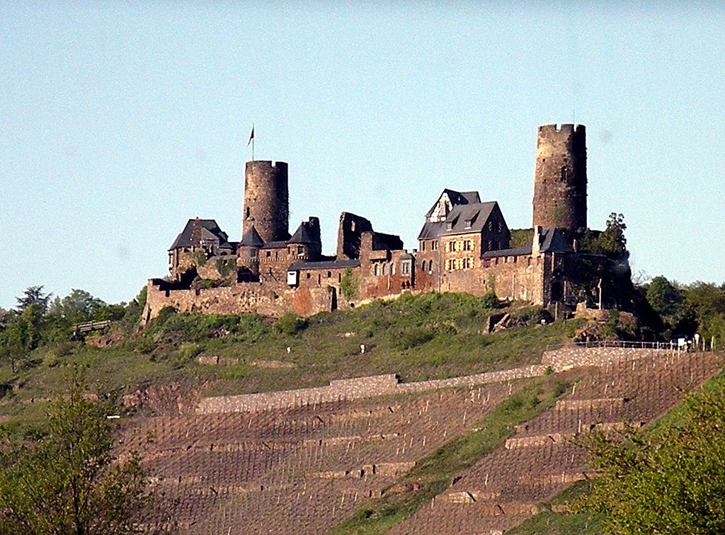
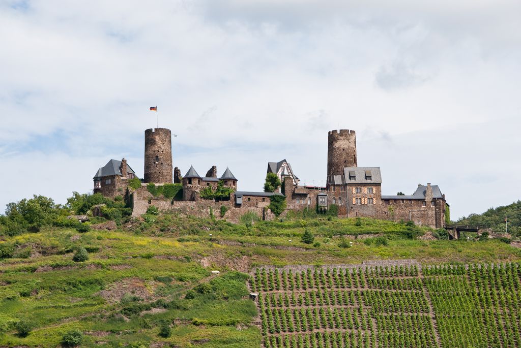
The ruins of the Thurant Castle (German: Burg Thurant, also Thurandt or Thurand) stand on a wide slate hill spur above the villages of Alken on the Moselle in Germany. The castle is in the district of Mayen-Koblenz in Rhineland-Palatinate and belongs to the spur castle type. Vine gardens on the sunniest slope. From the mid-13th century the archbishops of Cologne and Trier were joint owners and had their respective property managed by burgraves. As a result, each half of the castle had its own bergfried, living/domestic buildings and entrance. From the early 16th century the double castle gradually fell into disrepair and was made a complete ruin during the destruction wrought by the War of the Palatine Succession. Robert Allmers (1872–1951) from Varel, co-founder of the Hansa Automobil company and, from 1914, director of Bremen's Hansa Lloyd factories, bought the site in 1911 and had part of it rebuilt. The castle is in private hands, but may be visited from March to mid-November for a fee. Under to the Heritage Monument Conservation Act of the state, the whole site is a protected monument so is incorporated into the state monument list. It is a protected cultural object under the Hague Convention, bearing its blue and white signs.
Show more
Sun and Moon
Mon
Tue
Wed
Thu
Fri
Sat
Sun
May 2022
Date and time
00:00
06:00
12:00
18:00
Today
--
--
Sunrise
--
Sunset
--
Moonrise
--
Moonset
Phase
🌔 Waxing Gibbous
The perfect light time for beautiful photos:
--
Sunrise
--
Sunset
PeakVisor app
Get the app on your smartphone
New Panorama Tools
Trace location on the map
Measure distances
All the instruments are available in the context menu as well.
We use GPS information embedded into the photo when it is available.
3D mountains overlay
Adjust mountain panorama to perfectly match your photos because recorded by camera photo position might be imprecise.
Move tool
Rotate tool
Zoom
More customization
Choose which peak labels should make into the final photo and what photo title should be.
Next
Photo Location
Satellitte
Flat map
Relief map
Latitude
Longitude
Altitude
OR
Latitude
°'''
Longitude
°'''
Apply
Register Peak
Peak Name
Latitude
Longitude
Altitude
Register
Teleport
PeakVisor
This 3D model of Sagarmatha National Park in Nepal was made using the PeakVisor app topographic data. The mobile app features higher precision models worldwide, more topographic details, and works offline. Download PeakVisor maps today.
Download OBJ model
PeakVisor
The download should start shortly. If you find it useful please consider supporting the PeakVisor app.
PeakVisor for iOS and Android
Be a superhero of outdoor navigation with state-of-the-art 3D maps and mountain identification in the palm of your hand!