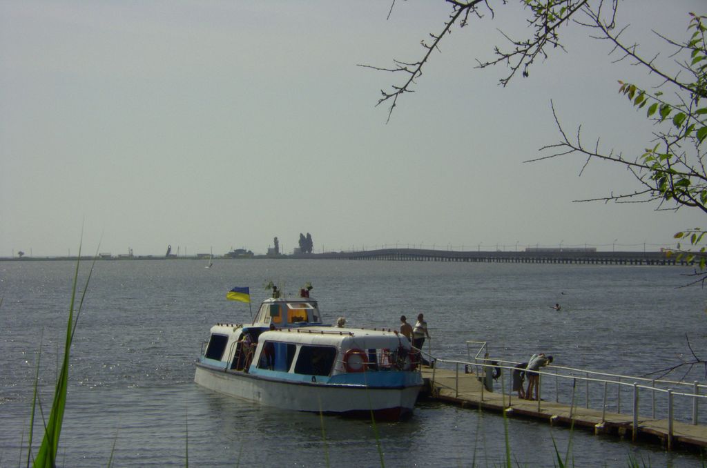
Budaki, or Budaksky Lagoon (other names: Shabolatsky Liman, Shabolat, Budaksky Liman; Ukrainian: Будацький лиман, Шаболат, Romanian: Limanul Budachi, Şabolat) is a Black Sea lagoon (liman) in Bessarabia, southern Ukraine. Located in 18 km from the city of Bilhorod-Dnistrovskyi. The lagoon is separated from the Black Sea by the 80–200 m wide sandbar. The health spa urban-type settlement of Serhiivka is located on the coasts of the Budaki Lagoon. The temporary connection between the lagoon and the sea is organised via artificial canal «Budaki» (on the southern west), sometime via natural erosion (washout) of the sandbar. The lagoon is connected to the Dniester Estuary via canals «Bugaz-1» and «Bugaz-2». In the central part of the lagoon, in the urban-type settlement of Serhiivka, the bridge is connect the town with the sandbar. The lagoon has 17 km long, 1.5 km wide, 0.8-2.4 m elevation, area of 27–32 km2. The length of the sandbar is about 18 km, its width is 80–200 m. The lagoon is shallow, maximal depth up to 2.2 m, average 1.05 m. In summer the temperature of the water is 26-28°С, up to 33 °C on shallow water. In the last 20 years the salinity of the liman is ranged between 2 and 32‰. Now the most desalinated part is the Akkembet Bay and the northeast of the lagoon, which connected to the Dniester Estuary (Salinity 2-14‰), and maximal mineralization is in southwest (15-32‰). The name of the lagoon, Budaki is the old name of the village of Prymorske, which origine from Turkish: Bucak, means "corner", "nook". Another name of the lagoon, Shabolat, is origine from the name of another village, Shabo (Turkish: Acha-abag - lower gardens), which located north from the lagoon.
Show more
Sun and Moon
Mon
Tue
Wed
Thu
Fri
Sat
Sun
May 2022
Date and time
00:00
06:00
12:00
18:00
Today
--
--
Sunrise
--
Sunset
--
Moonrise
--
Moonset
Phase
🌔 Waxing Gibbous
The perfect light time for beautiful photos:
--
Sunrise
--
Sunset
PeakVisor app
Get the app on your smartphone
New Panorama Tools
Trace location on the map
Measure distances
All the instruments are available in the context menu as well.
We use GPS information embedded into the photo when it is available.
3D mountains overlay
Adjust mountain panorama to perfectly match your photos because recorded by camera photo position might be imprecise.
Move tool
Rotate tool
Zoom
More customization
Choose which peak labels should make into the final photo and what photo title should be.
Next
Photo Location
Satellitte
Flat map
Relief map
Latitude
Longitude
Altitude
OR
Latitude
°'''
Longitude
°'''
Apply
Register Peak
Peak Name
Latitude
Longitude
Altitude
Register
Teleport
PeakVisor
This 3D model of Sagarmatha National Park in Nepal was made using the PeakVisor app topographic data. The mobile app features higher precision models worldwide, more topographic details, and works offline. Download PeakVisor maps today.
Download OBJ model
PeakVisor
The download should start shortly. If you find it useful please consider supporting the PeakVisor app.
PeakVisor for iOS and Android
Be a superhero of outdoor navigation with state-of-the-art 3D maps and mountain identification in the palm of your hand!


_-_traghetto_e_ponte.jpg)


