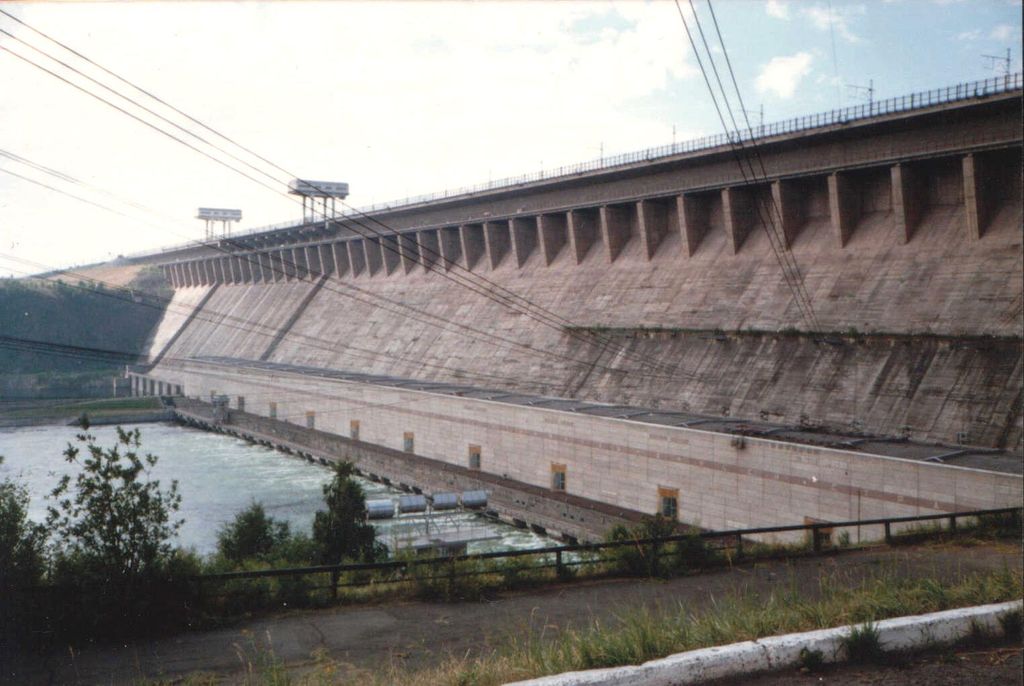
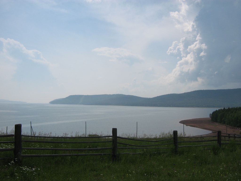
Bratsk Reservoir (Russian: Братское водохранилище, romanized: Bratskoye vodokhranilishche) is a reservoir on the Angara River, located in the Lena-Angara Plateau of Irkutsk Oblast, Russia. It is named after the city of Bratsk, the largest city adjacent to the reservoir. It has a surface area of 5,470 km2 (2,110 sq mi) and a maximum volume of 169.27×10¹² litres (3.723×10¹³ imp gal; 4.472×10¹³ US gal). The concrete dam of the Bratsk hydroelectric plant was completed in 1967. It is 125 metres (410 ft) high and 4,417 metres (14,491 ft) long. The Baikal Amur Mainline railroad runs along the top of the dam. Its electrical power capacity is 4,500 MW. To this day, it is classified as the second biggest dam in the world by reservoir storage capacity. Bratsk Reservoir is multi-purpose, and used in an integrated way for hydropower, water transport, water supply, forestry, fisheries and recreation. There are 25 different kinds of fish in the reservoir, 10 are suitable for commercial purposes. The quality of the water has been classified as ranging from category 2 'clean', to category 5 'dirty', for a number of factors. Drinking water is sourced from the 'clean' zones.
Show more
Sun and Moon
Mon
Tue
Wed
Thu
Fri
Sat
Sun
May 2022
Date and time
00:00
06:00
12:00
18:00
Today
--
--
Sunrise
--
Sunset
--
Moonrise
--
Moonset
Phase
🌔 Waxing Gibbous
The perfect light time for beautiful photos:
--
Sunrise
--
Sunset
PeakVisor app
Get the app on your smartphone
New Panorama Tools
Trace location on the map
Measure distances
All the instruments are available in the context menu as well.
We use GPS information embedded into the photo when it is available.
3D mountains overlay
Adjust mountain panorama to perfectly match your photos because recorded by camera photo position might be imprecise.
Move tool
Rotate tool
Zoom
More customization
Choose which peak labels should make into the final photo and what photo title should be.
Next
Photo Location
Satellitte
Flat map
Relief map
Latitude
Longitude
Altitude
OR
Latitude
°'''
Longitude
°'''
Apply
Register Peak
Peak Name
Latitude
Longitude
Altitude
Register
Teleport
PeakVisor
This 3D model of Sagarmatha National Park in Nepal was made using the PeakVisor app topographic data. The mobile app features higher precision models worldwide, more topographic details, and works offline. Download PeakVisor maps today.
Download OBJ model
PeakVisor
The download should start shortly. If you find it useful please consider supporting the PeakVisor app.
PeakVisor for iOS and Android
Be a superhero of outdoor navigation with state-of-the-art 3D maps and mountain identification in the palm of your hand!