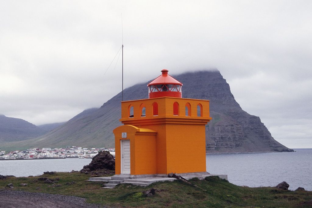
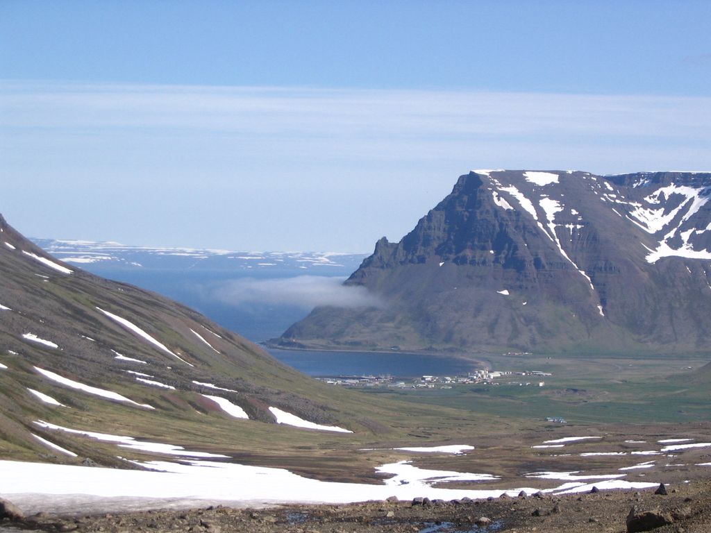
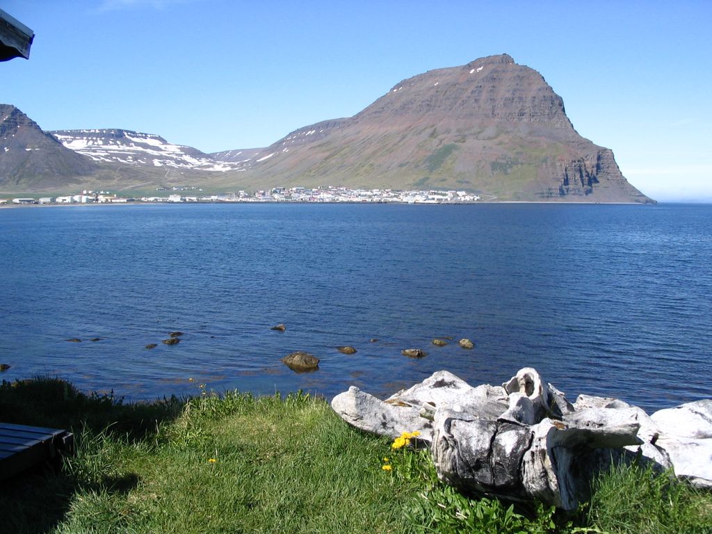
Bolungarvík (Icelandic pronunciation: [ˈpɔːluŋkarˌviːk] , regionally also [-lʏŋk-]) is a small town and the only built-up area in the municipality of Bolungarvíkurkaupstaður in the northwest of Iceland, located on the Westfjords peninsula, approximately 14 km (8.7 mi) from the town of Ísafjörður and 473 km (294 mi) from the capital city Reykjavík. Bolungarvík is close to abundant fishing grounds and has been used as an outpost for fishing since the 17th century, making it one of the earliest in Iceland. The village was not accessible by road until 1950, and in 2010 the Bolungarvíkurgöng tunnel was opened under the Óshlíð mountain to bypass the old road, which was frequently subject to avalanches and rock falls. Tourist sites include the Ósvör Maritime Museum, featuring a restored 19th-century fishing hut, a natural history museum, which houses taxidermied animals including a polar bear and the biggest bird collection in Iceland, and an indoor swimming pool with outdoor hot tubs and a water slide. Skálavík bay can be reached by a gravel road from June through August, and that same road also leads to the top of the Bolafjall mountain (638 m.) with views of the village of Bolungarvík, the Latrar Air Station, the Ísafjarðardjúp fjord, the Jökulfirðir fjords, the Hornstrandir nature reserve and the Denmark Strait. The surroundings of Bolungarvík are destinations for hiking, horse riding, sea angling and birdwatching.
Show more
Sun and Moon
Mon
Tue
Wed
Thu
Fri
Sat
Sun
May 2022
Date and time
00:00
06:00
12:00
18:00
Today
--
--
Sunrise
--
Sunset
--
Moonrise
--
Moonset
Phase
🌔 Waxing Gibbous
The perfect light time for beautiful photos:
--
Sunrise
--
Sunset
PeakVisor app
Get the app on your smartphone
New Panorama Tools
Trace location on the map
Measure distances
All the instruments are available in the context menu as well.
We use GPS information embedded into the photo when it is available.
3D mountains overlay
Adjust mountain panorama to perfectly match your photos because recorded by camera photo position might be imprecise.
Move tool
Rotate tool
Zoom
More customization
Choose which peak labels should make into the final photo and what photo title should be.
Next
Photo Location
Satellitte
Flat map
Relief map
Latitude
Longitude
Altitude
OR
Latitude
°'''
Longitude
°'''
Apply
Register Peak
Peak Name
Latitude
Longitude
Altitude
Register
Teleport
PeakVisor
This 3D model of Sagarmatha National Park in Nepal was made using the PeakVisor app topographic data. The mobile app features higher precision models worldwide, more topographic details, and works offline. Download PeakVisor maps today.
Download OBJ model
PeakVisor
The download should start shortly. If you find it useful please consider supporting the PeakVisor app.
PeakVisor for iOS and Android
Be a superhero of outdoor navigation with state-of-the-art 3D maps and mountain identification in the palm of your hand!