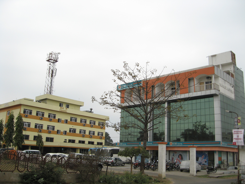
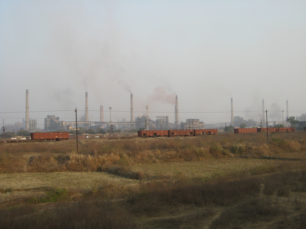
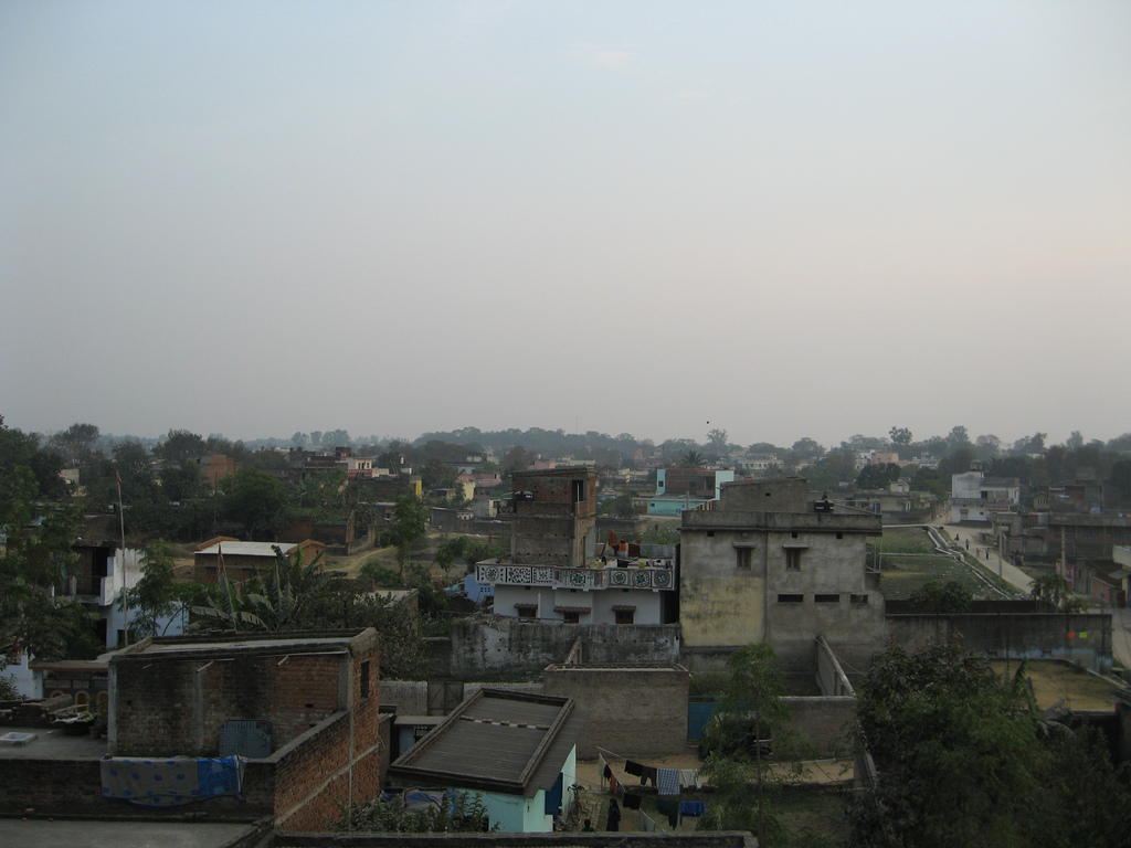
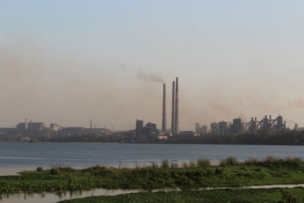
Bokaro, officially known as Bokaro Steel City (), is a large and planned city in Jharkhand, India. It is the fourth most populous city in the state and one of the first planned cities of India. Bokaro is the administrative headquarters of Bokaro district. The city is located on the banks of Garga River and on the fringes of Bokaro river and is surrounded by hill ranges at Giridih and Ramgarh districts. It is one of the most peaceful cities in India. As per 2011 census, the city's population was 563,417 and 1,100,000 of its metropolitan area. The city span across 183 km in geographic area. Marafari is the oldest settlement in Bokaro which was just a village during the time of Mughals and Sultanates. The nearby cities of Purulia was ruled by Maharaja of Kashipur. Manbhum region also covered Bokaro which was ruled by Mughal and Sultanates. After independence, it became a part of Bihar state. Bokaro Steel City is the headquarters of the Bokaro District as well as Koylanchal range (Bokaro, Dhanbad and Giridih) and is also one of the headquarters of the Police IG zone, apart from Ranchi and Dumka, covering seven districts- Hazaribagh, Dhanbad, Giridih, Koderma, Chatra, Bokaro, and Ramgarh (North Chotanagpur Division). Bokaro has emerged as a commercial, industrial, healthcare, sports, educational and startup hub. It is India's first global active city (GAC). Private property is absent in the city, with all property being public-owned. Despite this, the city has a cosmopolitan culture with people belonging to different ethnicity from South India as well as North India, representing its unique attributes, giving the city the character of Mini India while having heavy an influence of Bihari and Bengali culture. The city hosts tourist spots such as Jawaharlal Nehru Biological Park, Pindrajora, Tenughat Dam etc. It has multiple big corporations operating such as Steel Authority of India, Bharat Coking Coal Limited, Bharat Petroleum Corporation Limited, Damodar Valley Corporation, Oil and Natural Gas Corporation, INOX Group, Jaypee Cement, Orica, Vedanta Resources, Dalmia Cement, Electrosteel Castings and various other industries. It lies on the mineral-rich Chota Nagpur Plateau and a Coal Bed Methane(Gas) reserves of 45 billion cubic metres. It has one of the most important coalfields of India in nearby areas which are Jharia, Kulti, West Bokaro, East Bokaro and Ramgarh.
Show more
Sun and Moon
Mon
Tue
Wed
Thu
Fri
Sat
Sun
May 2022
Date and time
00:00
06:00
12:00
18:00
Today
--
--
Sunrise
--
Sunset
--
Moonrise
--
Moonset
Phase
🌔 Waxing Gibbous
The perfect light time for beautiful photos:
--
Sunrise
--
Sunset
PeakVisor app
Get the app on your smartphone
New Panorama Tools
Trace location on the map
Measure distances
All the instruments are available in the context menu as well.
We use GPS information embedded into the photo when it is available.
3D mountains overlay
Adjust mountain panorama to perfectly match your photos because recorded by camera photo position might be imprecise.
Move tool
Rotate tool
Zoom
More customization
Choose which peak labels should make into the final photo and what photo title should be.
Next
Photo Location
Satellitte
Flat map
Relief map
Latitude
Longitude
Altitude
OR
Latitude
°'''
Longitude
°'''
Apply
Register Peak
Peak Name
Latitude
Longitude
Altitude
Register
Teleport
PeakVisor
This 3D model of Sagarmatha National Park in Nepal was made using the PeakVisor app topographic data. The mobile app features higher precision models worldwide, more topographic details, and works offline. Download PeakVisor maps today.
Download OBJ model
PeakVisor
The download should start shortly. If you find it useful please consider supporting the PeakVisor app.
PeakVisor for iOS and Android
Be a superhero of outdoor navigation with state-of-the-art 3D maps and mountain identification in the palm of your hand!