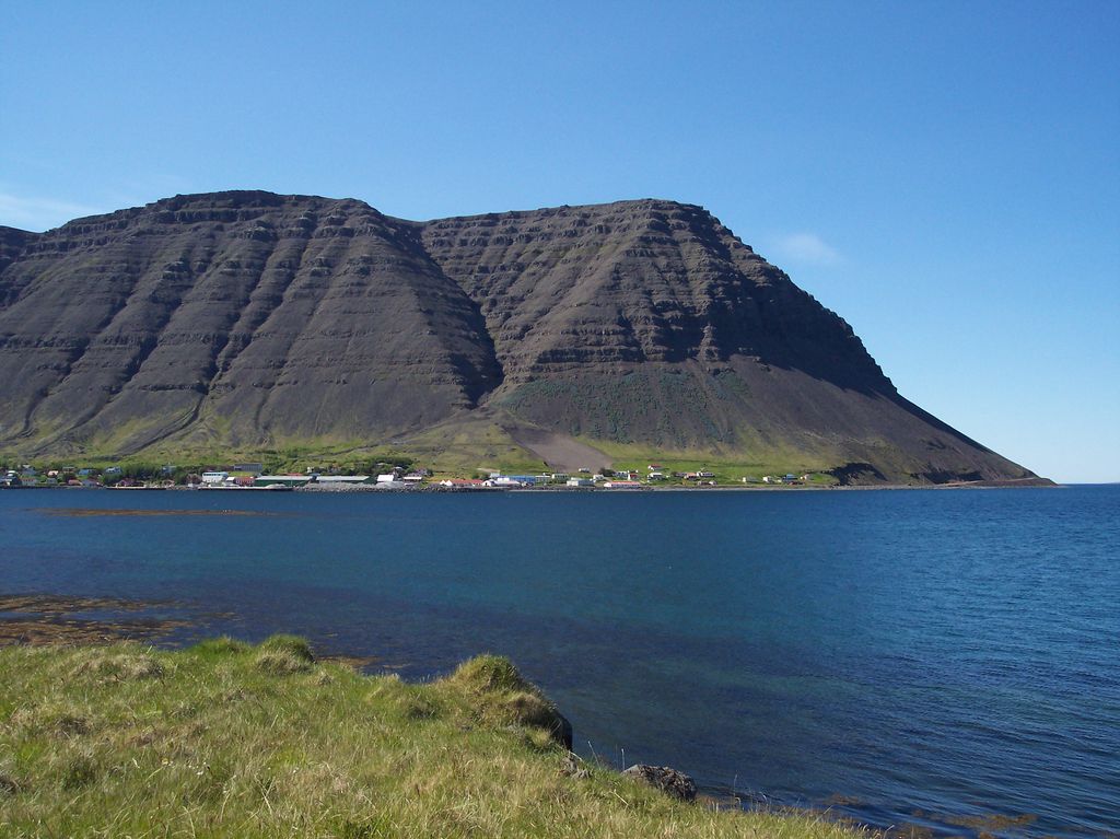
Bíldudalur (Icelandic pronunciation: [ˈpiltʏˌtaːlʏr̥] ) is a village situated on the coast of Arnarfjörður, one of the Westfjords in Iceland. It is situated in the Vesturbyggð municipality and has 238 inhabitants (as of January 2021). The village prospered in the 19th century thanks to sound business enterprise and the booming fishing industry. Ólafur Thorlacius (1761–1815) set up business in Bíldudalur following the end of the Danish trade monopoly. He was one of the most influential businessmen in Iceland at the beginning of the 19th century. He bought and sold fish, traded goods and ran his own small fishing fleet. One of his successors, Pétur J. Thorsteinsson (1854–1924) successfully continued this operation. In the late 20th and early 21st centuries, the decline of the fishing industry and the imposition of strict quotas by the Icelandic government led the town to diversify its economy. The village is now home to a factory, which provides employment to many residents, processing a mineral-rich algae found in abundance in the fjord. The village is also becoming a popular tourist destination, especially for fishing trips and for artists seeking to gain inspiration from the spectacular scenery. Close by the town there is also a fjord of literary significance, Geirþjófsfjörður, where the Icelandic Gísla saga was played out.
Show more
Sun and Moon
Mon
Tue
Wed
Thu
Fri
Sat
Sun
May 2022
Date and time
00:00
06:00
12:00
18:00
Today
--
--
Sunrise
--
Sunset
--
Moonrise
--
Moonset
Phase
🌔 Waxing Gibbous
The perfect light time for beautiful photos:
--
Sunrise
--
Sunset
PeakVisor app
Get the app on your smartphone
New Panorama Tools
Trace location on the map
Measure distances
All the instruments are available in the context menu as well.
We use GPS information embedded into the photo when it is available.
3D mountains overlay
Adjust mountain panorama to perfectly match your photos because recorded by camera photo position might be imprecise.
Move tool
Rotate tool
Zoom
More customization
Choose which peak labels should make into the final photo and what photo title should be.
Next
Photo Location
Satellitte
Flat map
Relief map
Latitude
Longitude
Altitude
OR
Latitude
°'''
Longitude
°'''
Apply
Register Peak
Peak Name
Latitude
Longitude
Altitude
Register
Teleport
PeakVisor
This 3D model of Sagarmatha National Park in Nepal was made using the PeakVisor app topographic data. The mobile app features higher precision models worldwide, more topographic details, and works offline. Download PeakVisor maps today.
Download OBJ model
PeakVisor
The download should start shortly. If you find it useful please consider supporting the PeakVisor app.
PeakVisor for iOS and Android
Be a superhero of outdoor navigation with state-of-the-art 3D maps and mountain identification in the palm of your hand!


.jpg)


