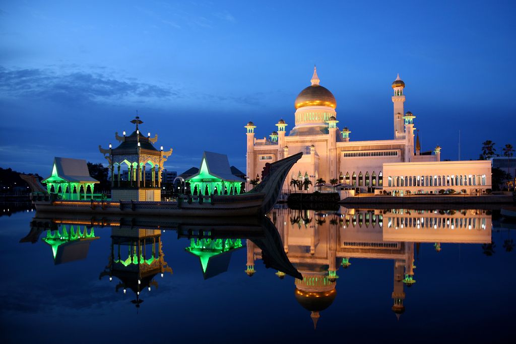
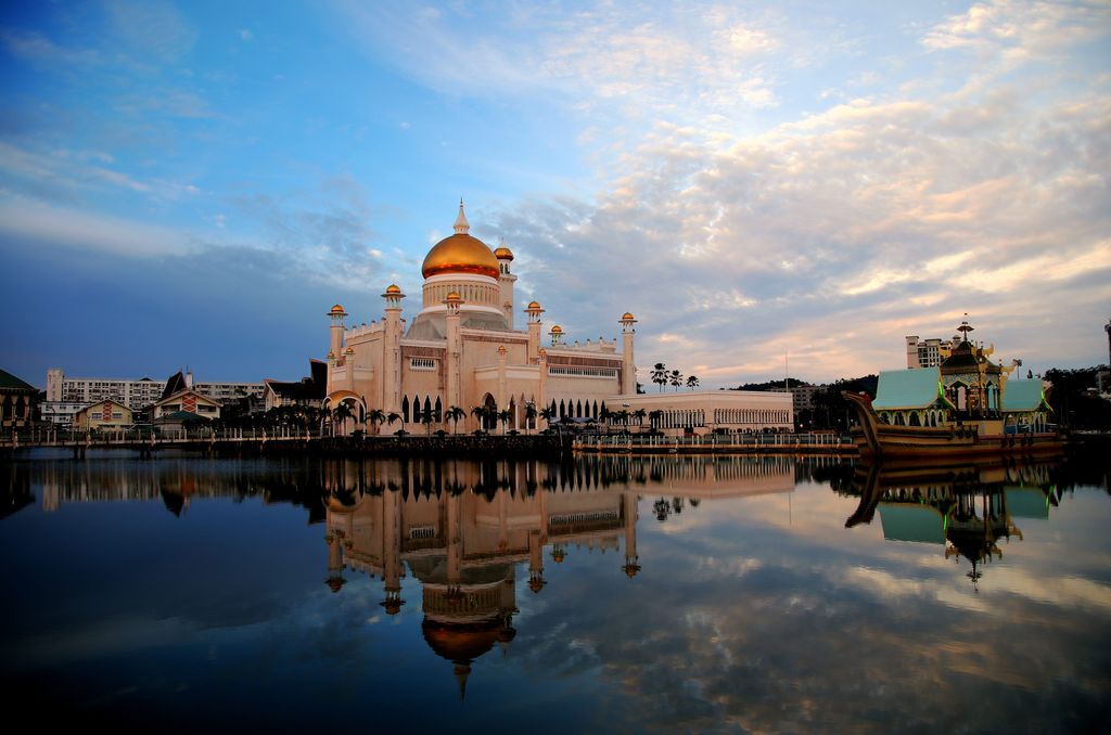
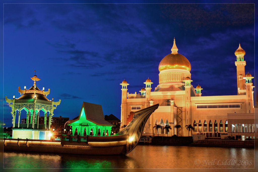
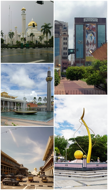
Bandar Seri Begawan (BSB; Jawi: بندر سري بڬاوان; Malay: [ˌbandar səˌri bəˈɡawan] ) is the capital and largest city of Brunei. It is officially a municipal area (kawasan bandaran) with an area of 100.36 square kilometres (38.75 sq mi) and an estimated population of 100,700 as of 2007. It is part of Brunei-Muara District, the smallest yet most populous district which is home to over 70 per cent of the country's population. It is the country's largest urban centre and nominally the country's only city. The capital is home to Brunei's seat of government, as well as a commercial and cultural centre. It was formerly known as Brunei Town until it was renamed in 1970 in honour of Sultan Omar Ali Saifuddien III, the 28th Sultan of Brunei and the father of the current Sultan, Hassanal Bolkiah. The history of Bandar Seri Begawan can be traced back to the establishment of a Malay stilt settlement on the waters of the Brunei River which became the predecessor of Kampong Ayer today. It became the capital of the Bruneian Sultanate from the 16th century onwards, as well as in the 19th century when it became a British protectorate. The establishment of a British Residency in the 20th century saw the establishment of modern-day administration on land, as well as the gradual resettlement of the riverine dwellers to the land. During World War II, the capital was occupied by the Japanese forces from 1941 and bombed in 1945 upon liberation by Allied forces. Brunei's independence from the British was declared on 1 January 1984 on a square in the city centre. Bandar Seri Begawan is home to Istana Nurul Iman, the largest residential palace in the world by the Guinness World Records, and Omar Ali Saifuddien Mosque, Brunei's iconic landmark. It is also home to Kampong Ayer, the largest 'water village' in the world and nicknamed Venice of the East. It was once the host city of the 20th Southeast Asian Games in 1999 and 8th APEC Summit in 2000.
Show more
Sun and Moon
Mon
Tue
Wed
Thu
Fri
Sat
Sun
May 2022
Date and time
00:00
06:00
12:00
18:00
Today
--
--
Sunrise
--
Sunset
--
Moonrise
--
Moonset
Phase
🌔 Waxing Gibbous
The perfect light time for beautiful photos:
--
Sunrise
--
Sunset
PeakVisor app
Get the app on your smartphone
New Panorama Tools
Trace location on the map
Measure distances
All the instruments are available in the context menu as well.
We use GPS information embedded into the photo when it is available.
3D mountains overlay
Adjust mountain panorama to perfectly match your photos because recorded by camera photo position might be imprecise.
Move tool
Rotate tool
Zoom
More customization
Choose which peak labels should make into the final photo and what photo title should be.
Next
Photo Location
Satellitte
Flat map
Relief map
Latitude
Longitude
Altitude
OR
Latitude
°'''
Longitude
°'''
Apply
Register Peak
Peak Name
Latitude
Longitude
Altitude
Register
Teleport
PeakVisor
This 3D model of Sagarmatha National Park in Nepal was made using the PeakVisor app topographic data. The mobile app features higher precision models worldwide, more topographic details, and works offline. Download PeakVisor maps today.
Download OBJ model
PeakVisor
The download should start shortly. If you find it useful please consider supporting the PeakVisor app.
PeakVisor for iOS and Android
Be a superhero of outdoor navigation with state-of-the-art 3D maps and mountain identification in the palm of your hand!


.jpg)


