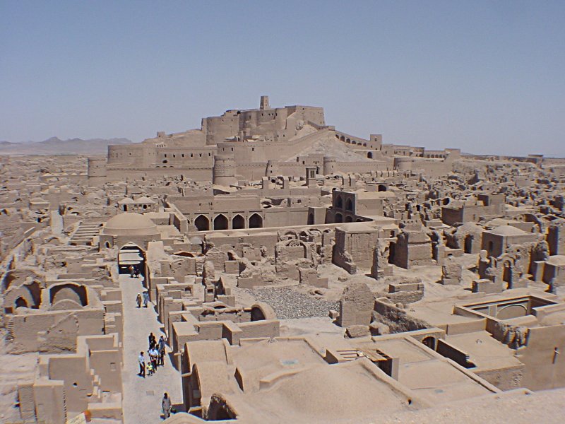
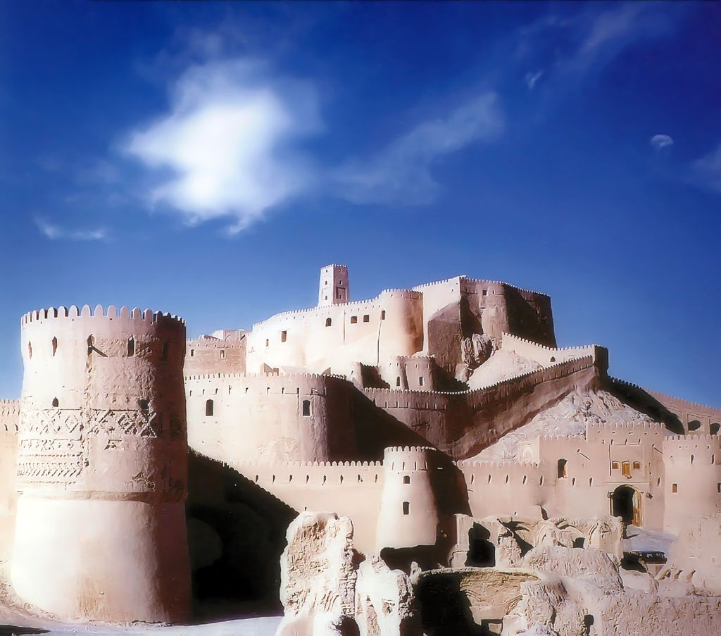
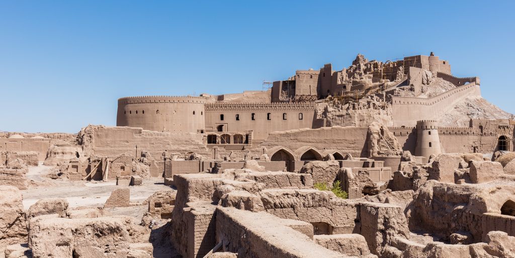
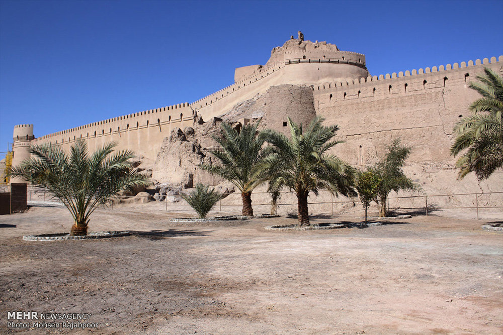
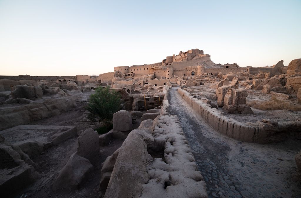
The Arg-e Bam (Persian: ارگ بم), located in the city of Bam, Kerman Province of southeastern Iran, is the largest adobe building in the world. The entire building was a large fortress containing the citadel, but because the citadel dominates the ruins, the entire fortress is now named Bam Citadel. Listed by UNESCO as part of the World Heritage Site "Bam and its Cultural Landscape", it can be traced back to at least the Achaemenid Empire (sixth to fourth centuries BC). The citadel rose to importance from the seventh to eleventh centuries, as a crossroads along the Silk Road and other important trade routes, and as a producer of silk and cotton garments. On 26 December 2003, the citadel was almost completely destroyed by an earthquake, along with much of the rest of Bam and its environs. A few days after the earthquake, the President of Iran, Mohammad Khatami, announced that the citadel would be rebuilt.
Show more
Sun and Moon
Mon
Tue
Wed
Thu
Fri
Sat
Sun
May 2022
Date and time
00:00
06:00
12:00
18:00
Today
--
--
Sunrise
--
Sunset
--
Moonrise
--
Moonset
Phase
🌔 Waxing Gibbous
The perfect light time for beautiful photos:
--
Sunrise
--
Sunset
PeakVisor app
Get the app on your smartphone
New Panorama Tools
Trace location on the map
Measure distances
All the instruments are available in the context menu as well.
We use GPS information embedded into the photo when it is available.
3D mountains overlay
Adjust mountain panorama to perfectly match your photos because recorded by camera photo position might be imprecise.
Move tool
Rotate tool
Zoom
More customization
Choose which peak labels should make into the final photo and what photo title should be.
Next
Photo Location
Satellitte
Flat map
Relief map
Latitude
Longitude
Altitude
OR
Latitude
°'''
Longitude
°'''
Apply
Register Peak
Peak Name
Latitude
Longitude
Altitude
Register
Teleport
PeakVisor
This 3D model of Sagarmatha National Park in Nepal was made using the PeakVisor app topographic data. The mobile app features higher precision models worldwide, more topographic details, and works offline. Download PeakVisor maps today.
Download OBJ model
PeakVisor
The download should start shortly. If you find it useful please consider supporting the PeakVisor app.
PeakVisor for iOS and Android
Be a superhero of outdoor navigation with state-of-the-art 3D maps and mountain identification in the palm of your hand!