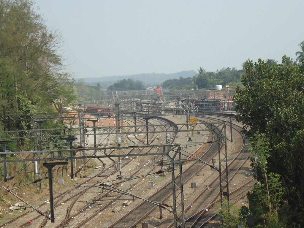
Angamaly for Kalady (station code: AFK) is an NSG–4 category Amruth Bharat Railway Station Amrit Bharat Station Scheme Indian railway station in Thiruvananthapuram railway division of Southern Railway zone. It is a railway station Located at Angamaly (major suburb of Kochi City) in Ernakulam district of Kerala state in India operated by Southern Railway Network. It lies in the Shoranur–Cochin Harbour section of Trivandrum division. Angamaly is the halting point for 48 trains including Express and all Passenger trains passing through this station. The railway station is located about 26 km from Ernakulam Town and 10 km from Aluva stations. It Is the nearest railway station of Cochin International Airport , 5 km apart, where above 10 million passengers traveling every year. This railway station has a Full Rake facility of Goods Yard and FCI private sidings railway line and TELK private siding railway line. Angamaly ranked 28 out of 104 for earnings during 2016–17 fiscal year. The proposed rail line to Sabarimala is starting from here. The proposed line starts from Angamaly in Ernakulam district and ends at Erumelli, one of the major Ayyappa pilgrims base camp centre, at Kottayam district. The centre has allocated a total outlay of Rs 923 crore to the state for various railway projects for the year 2018–19. The new projects announced are the Rs 1518-crore doubling in the Thiruvananthapuram–Kanyakumari section and a third line in the 107-km-long Ernakulam–Shornur congested sector. The estimated cost of the project when it was conceived years ago was Rs 517 crore. But due to delay in implementation, the cost had escalated to Rs 1,566 crore now.
We use GPS information embedded into the photo when it is available.
3D mountains overlay
Adjust mountain panorama to perfectly match your photos because recorded by camera photo position might be imprecise.
Move tool
Rotate tool
Zoom
More customization
Choose which peak labels should make into the final photo and what photo title should be.
Next
Photo Location
Satellitte
Flat map
Relief map
Latitude
Longitude
Altitude
OR
Latitude
°'''
Longitude
°'''
Apply
Register Peak
Peak Name
Latitude
Longitude
Altitude
Register
Teleport
PeakVisor
This 3D model of Sagarmatha National Park in Nepal was made using the PeakVisor app topographic data. The mobile app features higher precision models worldwide, more topographic details, and works offline. Download PeakVisor maps today.
Download OBJ model
PeakVisor
The download should start shortly. If you find it useful please consider supporting the PeakVisor app.
PeakVisor for iOS and Android
Be a superhero of outdoor navigation with state-of-the-art 3D maps and mountain identification in the palm of your hand!