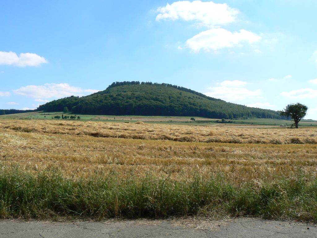
The Veitskopf is a hill, 428 m above sea level (NHN), in the Eifel mountains of Germany. It is located in the county of Ahrweiler in the state of Rhineland-Palatinate. It rises north of the lake of Laacher See in the area of the village of Wassenach.
The Veitskopf is the cinder cone of a volcano that erupted during the Quaternary period. Because there are no reference strata, its age cannot be accurately estimated. The Veitskopf produced three lava flows, of which the first and easily the largest spread out northwards from the crater rim in the west. Because the neighbouring valley, the Gleeser Tal, was formed after the eruption of the Veitskopf, this lava flow stands above the present valley and forms the so-called Mauerley. The two lava streams that run in a southerly direction are nowhere near as large and were first identified from magnetic surveys because they were covered by a layer of pumice. At the top of the Veitskopf is the Lydia Tower which enables an all-round view that includes the Laacher See, the Brohltal valley and even the Siebengebirge hills.
We use GPS information embedded into the photo when it is available.
3D mountains overlay
Adjust mountain panorama to perfectly match your photos because recorded by camera photo position might be imprecise.
Move tool
Rotate tool
Zoom
More customization
Choose which peak labels should make into the final photo and what photo title should be.
Next
Photo Location
Satellitte
Flat map
Relief map
Latitude
Longitude
Altitude
OR
Latitude
°'''
Longitude
°'''
Apply
Register Peak
Peak Name
Latitude
Longitude
Altitude
Register
Teleport
PeakVisor
This 3D model of Sagarmatha National Park in Nepal was made using the PeakVisor app topographic data. The mobile app features higher precision models worldwide, more topographic details, and works offline. Download PeakVisor maps today.
Download OBJ model
PeakVisor
The download should start shortly. If you find it useful please consider supporting the PeakVisor app.
PeakVisor for iOS and Android
Be a superhero of outdoor navigation with state-of-the-art 3D maps and mountain identification in the palm of your hand!