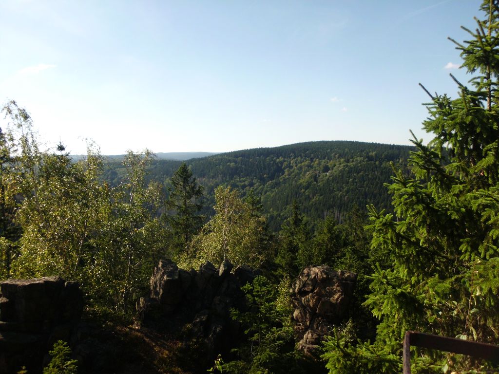
The Taubenklippe is a rock formation in the Harz mountains in the German state of Saxony-Anhalt. It lies about halfway between Bad Harzburg and Ilsenburg at a height of 572 m above NN on the eastern slopes of the Ecker valley. From the crag there is a good view over Harz Foreland, the heights near Bad Harzburg and the highest mountain in the Har, the Brocken. The Taubenklippe may be reached from the Ecker valley on a footpath, some 6 km long, that starts in Ilsenburg.
The Taubenklippe is checkpoint number 4 in the Harzer Wandernadel hiking trail network.
See also: List of rock formations in the Harz
There's a hiking trail (T2) leading to the summit.
The nearest mountain hut is Zwiesselkopf Hütte located 1 203m/3 947ft E of the summit.
We use GPS information embedded into the photo when it is available.
3D mountains overlay
Adjust mountain panorama to perfectly match your photos because recorded by camera photo position might be imprecise.
Move tool
Rotate tool
Zoom
More customization
Choose which peak labels should make into the final photo and what photo title should be.
Next
Photo Location
Satellitte
Flat map
Relief map
Latitude
Longitude
Altitude
OR
Latitude
°'''
Longitude
°'''
Apply
Register Peak
Peak Name
Latitude
Longitude
Altitude
Register
Teleport
PeakVisor
This 3D model of Sagarmatha National Park in Nepal was made using the PeakVisor app topographic data. The mobile app features higher precision models worldwide, more topographic details, and works offline. Download PeakVisor maps today.
Download OBJ model
PeakVisor
The download should start shortly. If you find it useful please consider supporting the PeakVisor app.
PeakVisor for iOS and Android
Be a superhero of outdoor navigation with state-of-the-art 3D maps and mountain identification in the palm of your hand!