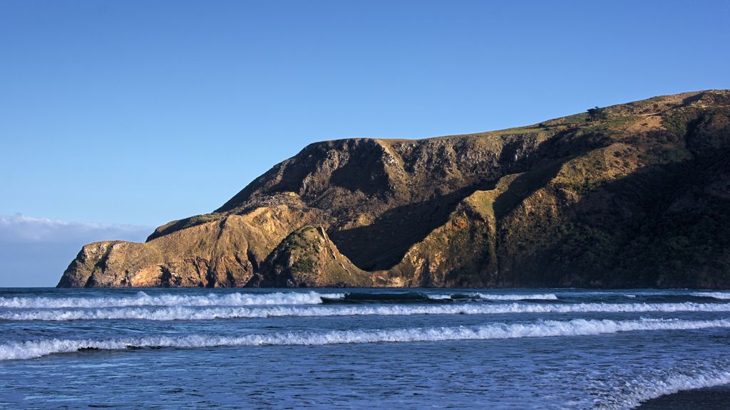
Sandymount is the name of a prominent hill on Otago Peninsula, in the southeastern South Island of New Zealand. It is 13 kilometres east of the city centre of Dunedin, close to the northeastern end of Sandfly Bay, and rises to a height of 312 metres. The eastern side of the hill meets the Pacific Ocean in a series of high cliffs and chasms, some of which are among the largest in New Zealand. Prominent among these are Lover's Leap and The Chasm, the former of which is 224 metres high.
The hill is named for the large dunes which rise up the southern flanks of the hill to a height of over 100 metres.
Lovers leap was named following a couple jumping to their deaths naked.
There's a trail called Sandymount Track leading to the summit.
We use GPS information embedded into the photo when it is available.
3D mountains overlay
Adjust mountain panorama to perfectly match your photos because recorded by camera photo position might be imprecise.
Move tool
Rotate tool
Zoom
More customization
Choose which peak labels should make into the final photo and what photo title should be.
Next
Photo Location
Satellitte
Flat map
Relief map
Latitude
Longitude
Altitude
OR
Latitude
°'''
Longitude
°'''
Apply
Register Peak
Peak Name
Latitude
Longitude
Altitude
Register
Teleport
PeakVisor
This 3D model of Sagarmatha National Park in Nepal was made using the PeakVisor app topographic data. The mobile app features higher precision models worldwide, more topographic details, and works offline. Download PeakVisor maps today.
Download OBJ model
PeakVisor
The download should start shortly. If you find it useful please consider supporting the PeakVisor app.
PeakVisor for iOS and Android
Be a superhero of outdoor navigation with state-of-the-art 3D maps and mountain identification in the palm of your hand!