The Remigiusberg in the county of Kusel in the German state of Rhineland-Palatinate is a hill, 368 metres high, which belongs to the western part of the North Palatine Uplands and only stands above the surrounding terrain by 120 metres.
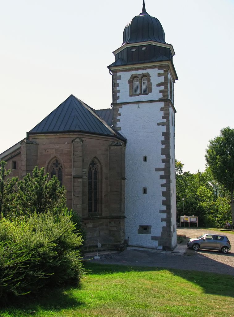
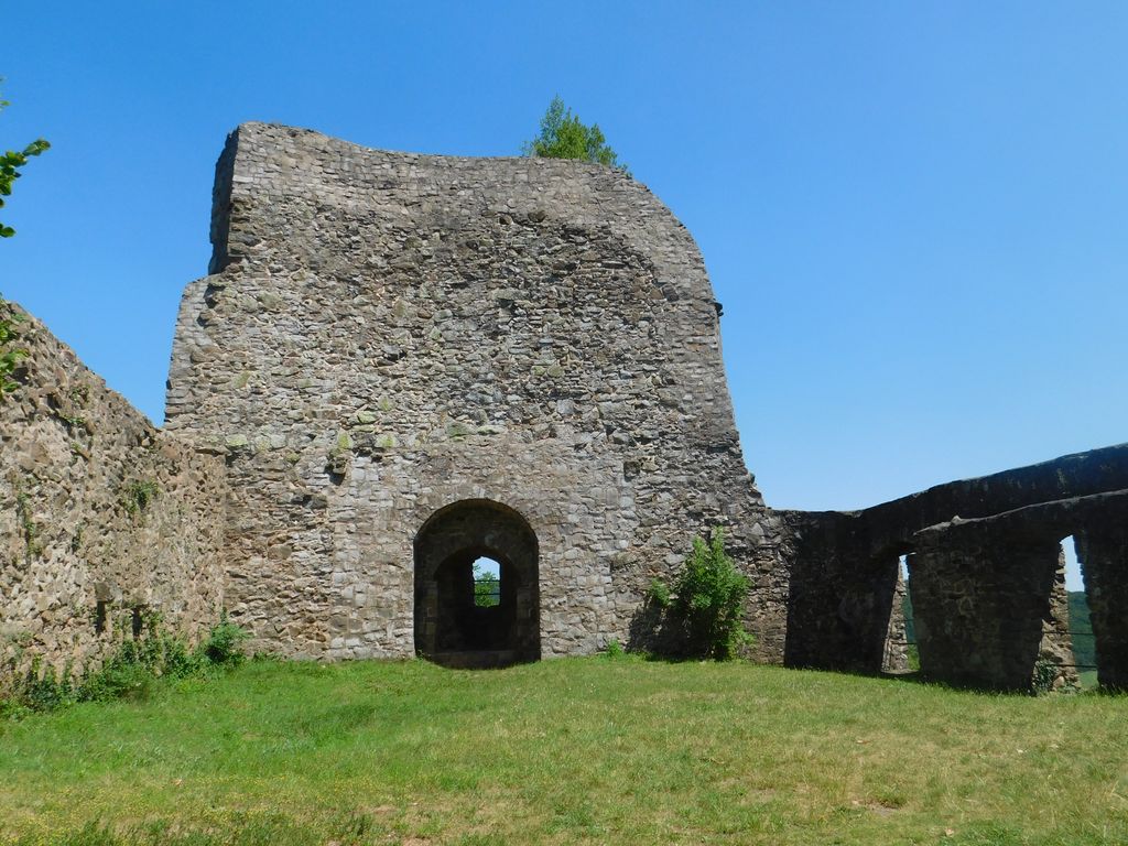
On its summit dome are the priory church of St. Remigius, the only surviving building of the old eponymous priory, and the ruins of Michelsburg Castle, which are close to one another and only separated by a shallow basin.
There's a hiking trail (T1) leading to the summit.
The nearest mountain hut is Buchwaldhütte located 1 096m/3 596ft E of the summit.
We use GPS information embedded into the photo when it is available.
3D mountains overlay
Adjust mountain panorama to perfectly match your photos because recorded by camera photo position might be imprecise.
Move tool
Rotate tool
Zoom
More customization
Choose which peak labels should make into the final photo and what photo title should be.
Next
Photo Location
Satellitte
Flat map
Relief map
Latitude
Longitude
Altitude
OR
Latitude
°'''
Longitude
°'''
Apply
Register Peak
Peak Name
Latitude
Longitude
Altitude
Register
Teleport
PeakVisor
This 3D model of Sagarmatha National Park in Nepal was made using the PeakVisor app topographic data. The mobile app features higher precision models worldwide, more topographic details, and works offline. Download PeakVisor maps today.
Download OBJ model
PeakVisor
The download should start shortly. If you find it useful please consider supporting the PeakVisor app.
PeakVisor for iOS and Android
Be a superhero of outdoor navigation with state-of-the-art 3D maps and mountain identification in the palm of your hand!