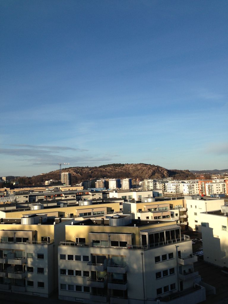
Ramberget (Swedish pronunciation: [ˈrâmːˌbærjɛt]; English: "Raven Hill") is a mountain on Hisingen island in Gothenburg, Sweden. The surrounding area and park is called Keillers Park. Ramberget is a popular tourist attraction and a place for outdoor recreation for Gothenburg residents, with walking paths, lookouts over the city of Gothenburg and artworks. Ramberget is with its highest point 87 metres (282 ft) above sea level, with a lower second point called Ättestupan. There is a road for cars going to the top of Ramberget. The park is about 31 hectares.
Ramberget got its characteristic shape already during the Ice Age 12,000 years ago. The northeast slope is flat while the south side has a higher cliff that is clearly visible from the river. The ice sheet has left traces both in the rock faces and through boulders in the area. Ramberget got its name of the old Swedish word "ram" which means raven. Ravens are still nesting on Ramberget.
Until the early 1800s, when it wood was still widely used as fuel, there were no trees on Ramberget which instead was covered with heather, later replanting made the wood grow back and today there is a lush vegetation of beech, larch, pine and oaks.
Most of the north shore of the river, including the area around Ramberget, was owned in the early 1900s by the Keiller family. Alexander Keiller, who came to Gothenburg from Scotland, had in the 1840s started a mechanical workshop that would later evolve into shipbuilding group Götaverken. During the recession of the 1860s, however, the company went into bankruptcy and after reorganization was Alexander's son James Keiller new manager. After some setbacks, including a severe fire in 1898, so James decided to pull back from the shops. 1906, he sold almost all of the business and in the same time he donated the area around Ramberget to the city, with the condition that the area would be used and remain a natural park. The deed of gift is that only buildings that are "for the park's care or the visiting public homelike" may be erected, with the exception of water reservoirs.
Keiller Park was designed in a National Romantic style, partly by Eugen Thorburn who also designed Kungsportsbron in central Gothenburg. The park was inaugurated Oct. 3, 1908.
The Göteborg Mosque is located at the foot of Ramberget.
We use GPS information embedded into the photo when it is available.
3D mountains overlay
Adjust mountain panorama to perfectly match your photos because recorded by camera photo position might be imprecise.
Move tool
Rotate tool
Zoom
More customization
Choose which peak labels should make into the final photo and what photo title should be.
Next
Photo Location
Satellitte
Flat map
Relief map
Latitude
Longitude
Altitude
OR
Latitude
°'''
Longitude
°'''
Apply
Register Peak
Peak Name
Latitude
Longitude
Altitude
Register
Teleport
PeakVisor
This 3D model of Sagarmatha National Park in Nepal was made using the PeakVisor app topographic data. The mobile app features higher precision models worldwide, more topographic details, and works offline. Download PeakVisor maps today.
Download OBJ model
PeakVisor
The download should start shortly. If you find it useful please consider supporting the PeakVisor app.
PeakVisor for iOS and Android
Be a superhero of outdoor navigation with state-of-the-art 3D maps and mountain identification in the palm of your hand!