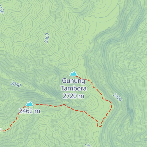
Mount Tambora, or Tomboro, is an active stratovolcano in West Nusa Tenggara, Indonesia. Located on Sumbawa in the Lesser Sunda Islands, it was formed by the active subduction zones beneath it. Before 1815, its elevation reached more than 4,300 metres (14,100 feet) high, making it one of the tallest peaks in the Indonesian archipelago.
Tambora violently erupted in a series of eruptions beginning 5 April 1815, culminating in the largest eruption in recorded human history and the largest of the Holocene (10,000 years ago to present). The magma chamber under Tambora had been drained by previous eruptions and underwent several centuries of dormancy as it refilled. Volcanic activity reached a peak that year, culminating in an explosive eruption. The explosion was heard on Sumatra island, more than 2,000 kilometres (1,200 miles) away. Heavy volcanic ash rains were observed as far away as Borneo, Sulawesi, Java, and Maluku islands, and the maximum elevation of Tambora was reduced from about 4,300 to 2,850 metres (14,110 to 9,350 feet). Although estimates vary, the death toll was at least 71,000 people. The eruption contributed to global climate anomalies in the following years, while 1816 became known as the "year without a summer" because of the impact on North American and European weather. In the Northern Hemisphere, crops failed and livestock died, resulting in the worst famine of the century.
We use GPS information embedded into the photo when it is available.
3D mountains overlay
Adjust mountain panorama to perfectly match your photos because recorded by camera photo position might be imprecise.
Move tool
Rotate tool
Zoom
More customization
Choose which peak labels should make into the final photo and what photo title should be.
Next
Photo Location
Satellitte
Flat map
Relief map
Latitude
Longitude
Altitude
OR
Latitude
°'''
Longitude
°'''
Apply
Register Peak
Peak Name
Latitude
Longitude
Altitude
Register
Teleport
PeakVisor
This 3D model of Sagarmatha National Park in Nepal was made using the PeakVisor app topographic data. The mobile app features higher precision models worldwide, more topographic details, and works offline. Download PeakVisor maps today.
Download OBJ model
PeakVisor
The download should start shortly. If you find it useful please consider supporting the PeakVisor app.
PeakVisor for iOS and Android
Be a superhero of outdoor navigation with state-of-the-art 3D maps and mountain identification in the palm of your hand!