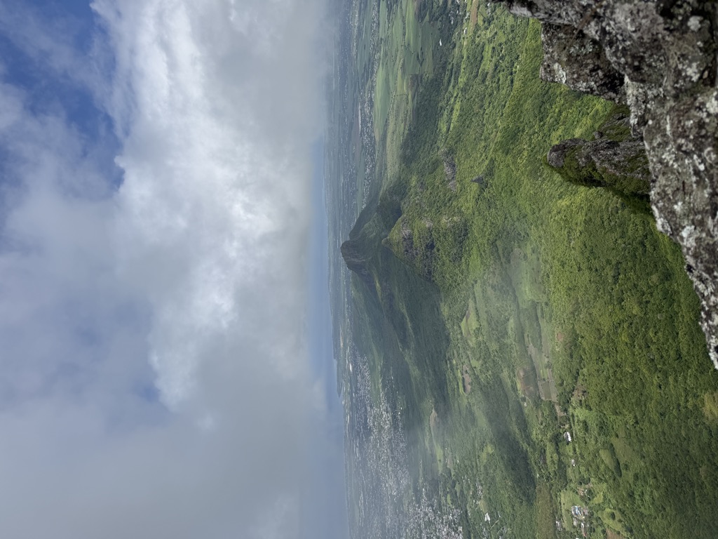
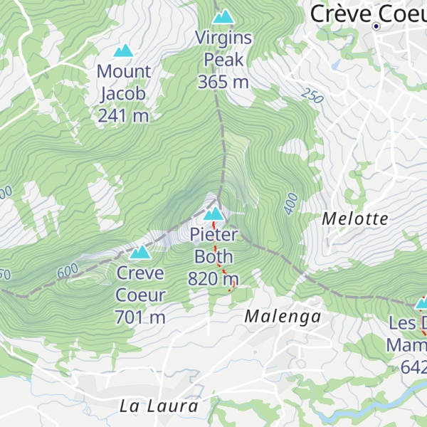
Pieter Both, sometimes referred to as Peter Botte Mountain, is the second highest mountain of Mauritius, at 820 metres (2,690 ft) tall. The mountain is slightly shorter than Piton de la Petite Rivière Noire by eight metres. It is named after Pieter Both, the first Governor-General of the Dutch East Indies. It is located in the Moka Range.
The notable feature of this mountain is the gigantic rock formation at the very top of it, which resembles a human head. The palm species Hyophorbe amaricaulis, famous for being the world's rarest palm today, was once a common sight on this mountain.
The first ascent of Pieter Both was by Captain Lloyd, Lieutenant Phillpotts, of the 29th Reg., Lieutenant Keppel, R.N., and Lieutenant Taylor on 7 September 1832.
To climb the mountain following the main ridge takes about an hour, and is mildly difficult. It is mainly a scramble, and being exposed, a rope is advised. The dramatic boulder on the pinnacle is about nine metres in diameter, and has several iron spikes fixed to it to aid climbing to the top. The top is flat and about two metres across.
There's a demading hiking trail (T3) called Pieter Both trail leading to the summit.
By elevation Pieter Both is
# 2 out of 33 in Moka # 1 out of 14 in Pamplemousses # 2 out of 20 in Port Louis # 3 out of 143 in Mauritius
By prominence Pieter Both is
# 1 out of 33 in Moka # 1 out of 14 in Pamplemousses # 1 out of 20 in Port Louis # 5 out of 143 in Mauritius
We use GPS information embedded into the photo when it is available.
3D mountains overlay
Adjust mountain panorama to perfectly match your photos because recorded by camera photo position might be imprecise.
Move tool
Rotate tool
Zoom
More customization
Choose which peak labels should make into the final photo and what photo title should be.
Next
Photo Location
Satellitte
Flat map
Relief map
Latitude
Longitude
Altitude
OR
Latitude
°'''
Longitude
°'''
Apply
Register Peak
Peak Name
Latitude
Longitude
Altitude
Register
Teleport
PeakVisor
This 3D model of Sagarmatha National Park in Nepal was made using the PeakVisor app topographic data. The mobile app features higher precision models worldwide, more topographic details, and works offline. Download PeakVisor maps today.
Download OBJ model
PeakVisor
The download should start shortly. If you find it useful please consider supporting the PeakVisor app.
PeakVisor for iOS and Android
Be a superhero of outdoor navigation with state-of-the-art 3D maps and mountain identification in the palm of your hand!