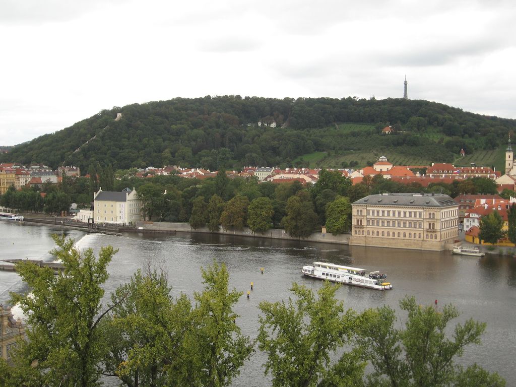
Petřín (Czech pronunciation: [ˈpɛtr̝̊iːn]) is a hill in the centre of Prague, Czech Republic. It rises 327 m above sea level and some 130 m above the left bank of the Vltava River. The hill, almost entirely covered with parks, is a favorite recreational area for the inhabitants of Prague. The hill (in German known as Laurenziberg) is featured prominently in Franz Kafka's early short story "Description of a Struggle" and briefly in Milan Kundera's novel The Unbearable Lightness of Being.
The chronicler Cosmas describes Petřín as a very rocky place, the hill is allegedly called Petřín because of the large number of rocks (Latin: petra). Since ancient times, stones were dug and were used to construct buildings in Prague. Medieval defence wall, the Hunger Wall was built on Petřín Hill during 1360 - 1362, by the order of king of Bohemia Charles IV. The Petřín Lookout Tower, which strongly resembles the Eiffel Tower, was built atop a hill in 1891. Other sights include the Rose Garden, Mirror Maze, Cathedral of Saint Lawrence, and St Michael Church.
The summit of the hill is linked to Prague's Malá Strana district by the Petřín funicular, a funicular railway that first operated in 1891.
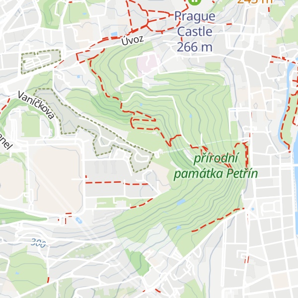
There's a trail leading to the summit.
By elevation Petřín is
# 1 out of 1 in přírodní památka Petřín # 18 out of 55 in Hlavní město Praha # 18 out of 55 in Prague
By prominence Petřín is
# 1 out of 1 in přírodní památka Petřín # 52 out of 55 in Hlavní město Praha # 52 out of 55 in Prague
We use GPS information embedded into the photo when it is available.
3D mountains overlay
Adjust mountain panorama to perfectly match your photos because recorded by camera photo position might be imprecise.
Move tool
Rotate tool
Zoom
More customization
Choose which peak labels should make into the final photo and what photo title should be.
Next
Photo Location
Satellitte
Flat map
Relief map
Latitude
Longitude
Altitude
OR
Latitude
°'''
Longitude
°'''
Apply
Register Peak
Peak Name
Latitude
Longitude
Altitude
Register
Teleport
PeakVisor
This 3D model of Sagarmatha National Park in Nepal was made using the PeakVisor app topographic data. The mobile app features higher precision models worldwide, more topographic details, and works offline. Download PeakVisor maps today.
Download OBJ model
PeakVisor
The download should start shortly. If you find it useful please consider supporting the PeakVisor app.
PeakVisor for iOS and Android
Be a superhero of outdoor navigation with state-of-the-art 3D maps and mountain identification in the palm of your hand!