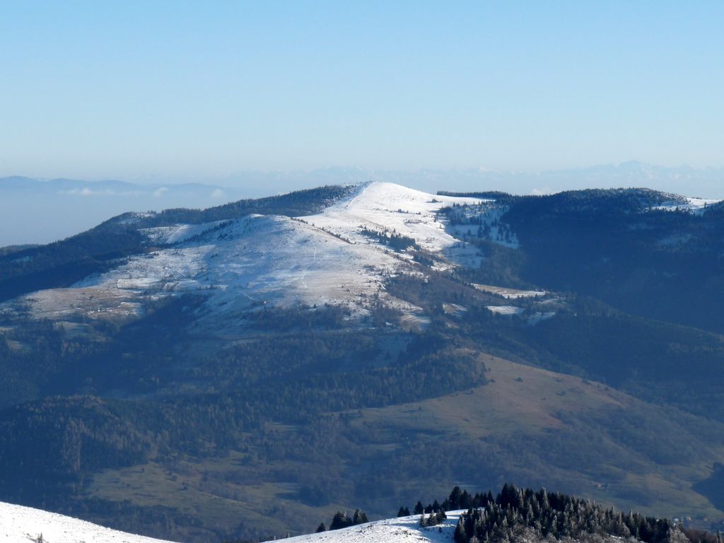
The Petit Ballon (German: Kleiner Belchen) or Little Belchen, is, at 1272m, one of the highest peaks of the Vosges Mountains in the department of Haut-Rhin, Alsace in France, about 5 km away from the village of Wasserbourg. The Rothenbrunnen mountain hut is 500m below. A car park is a further 500m away.
The Col du Petit Ballon pass (elevation 1,163 m (3,816 ft)) is close to the summit.
The mountain is part of the Belchen System, a group of mountains with the name "Belchen" (in German) that may have been part of a Celtic sun calendar.
There's a hiking trail (T1) leading to the summit.
The nearest mountain hut is Refuge Rothenbrunnen (Amis de la Nature) located 318m/1 044ft W of the summit.
By elevation Petit Ballon is
# 24 out of 1710 in Grand Est # 24 out of 391 in Haut-Rhin
By prominence Petit Ballon is
# 75 out of 1710 in Grand Est # 23 out of 391 in Haut-Rhin
We use GPS information embedded into the photo when it is available.
3D mountains overlay
Adjust mountain panorama to perfectly match your photos because recorded by camera photo position might be imprecise.
Move tool
Rotate tool
Zoom
More customization
Choose which peak labels should make into the final photo and what photo title should be.
Next
Photo Location
Satellitte
Flat map
Relief map
Latitude
Longitude
Altitude
OR
Latitude
°'''
Longitude
°'''
Apply
Register Peak
Peak Name
Latitude
Longitude
Altitude
Register
Teleport
PeakVisor
This 3D model of Sagarmatha National Park in Nepal was made using the PeakVisor app topographic data. The mobile app features higher precision models worldwide, more topographic details, and works offline. Download PeakVisor maps today.
Download OBJ model
PeakVisor
The download should start shortly. If you find it useful please consider supporting the PeakVisor app.
PeakVisor for iOS and Android
Be a superhero of outdoor navigation with state-of-the-art 3D maps and mountain identification in the palm of your hand!