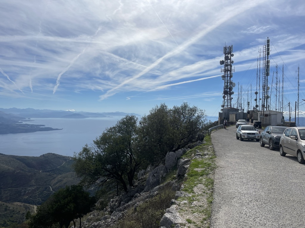
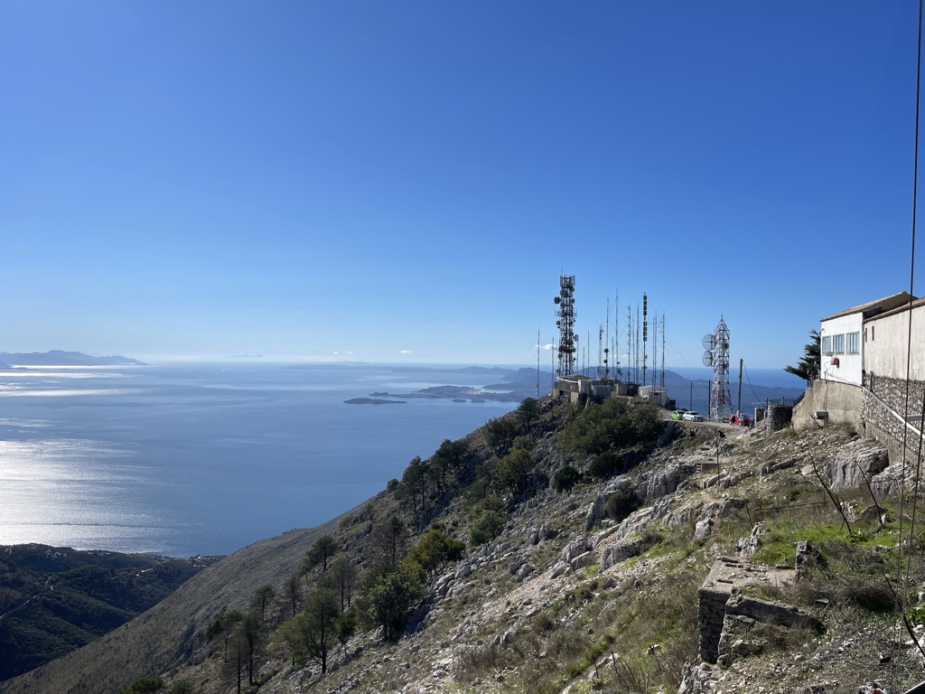
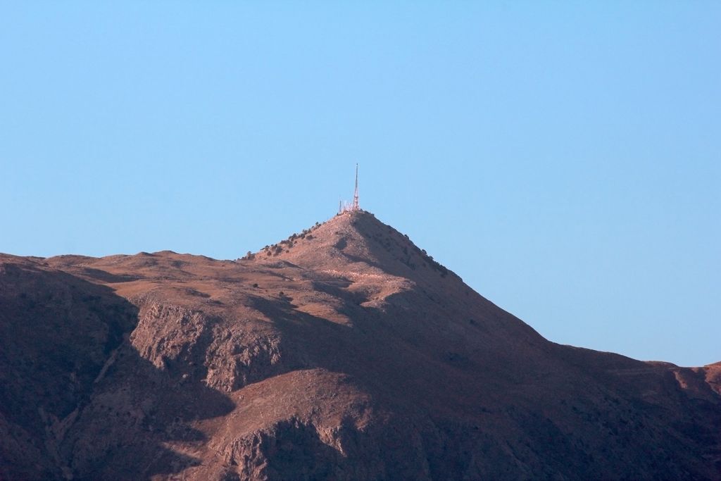
Mount Pantokrator (sometimes Pantocrator, Pantōkrator, Παντοκράτωρ in Greek) is a mountain located in north-eastern Corfu. At 906 metres (2,972 ft), it is the highest mountain on the island. At the summit, the whole of Corfu can be seen, as well as Albania which lies a short distance from the island. On particularly clear days it is also possible to see Italy despite it being around 130 km (81 mi) away. At the top there is a café for tourists, a telecommunications station, whose largest tower stands directly over a well, and a monastery. The first monastery on the site was Angevin, built in 1347 but then destroyed sometime around 1537. The current church on the site dates from around 1689, and the current facade was built during the 19th century. It is dedicated to the transfiguration of Christ. To get to the peak, you can either drive to Mount Pantokrator up a series of winding roads from the coast, or walk to the top. If you choose to walk, one of the best places to start is in Old Perithia, Corfu's oldest village, where it takes approximately 2 hours for a round trip. The village of Old Perithia dates back to the 14th century and the 'Perithians' helped build the original monastery using local wood and limestone. The village of Old Perithia (and the now abandoned village of Sinies) can be seen from Pantokrator and with its 130 house and 8 churches Old Perithia is said to sit at the foot of Pantokrator, 'The Almighty.' The walk to Pantokrator from Spartilas is part of The Corfu Trail, an established long distance walking route of about 200 km from South to North Corfu. It's also possible to walk from Old Perithia to the summit of Pantokrator.
There's a trail leading to the summit.
By elevation Pantokrator is
# 1 out of 1 in Ψηλός Παντοκράτωρ (Σπαρτύλας-Πεταλείας-Νησακίου) # 1 out of 22 in Corfu Regional Unit
By prominence Pantokrator is
# 1 out of 1 in Ψηλός Παντοκράτωρ (Σπαρτύλας-Πεταλείας-Νησακίου) # 1 out of 22 in Corfu Regional Unit # 73 out of 4199 in Greece # 15 out of 935 in Peloponnese, West Greece and Ionian Sea # 66 out of 3910 in the Greek Ranges
We use GPS information embedded into the photo when it is available.
3D mountains overlay
Adjust mountain panorama to perfectly match your photos because recorded by camera photo position might be imprecise.
Move tool
Rotate tool
Zoom
More customization
Choose which peak labels should make into the final photo and what photo title should be.
Next
Photo Location
Satellitte
Flat map
Relief map
Latitude
Longitude
Altitude
OR
Latitude
°'''
Longitude
°'''
Apply
Register Peak
Peak Name
Latitude
Longitude
Altitude
Register
Teleport
PeakVisor
This 3D model of Sagarmatha National Park in Nepal was made using the PeakVisor app topographic data. The mobile app features higher precision models worldwide, more topographic details, and works offline. Download PeakVisor maps today.
Download OBJ model
PeakVisor
The download should start shortly. If you find it useful please consider supporting the PeakVisor app.
PeakVisor for iOS and Android
Be a superhero of outdoor navigation with state-of-the-art 3D maps and mountain identification in the palm of your hand!