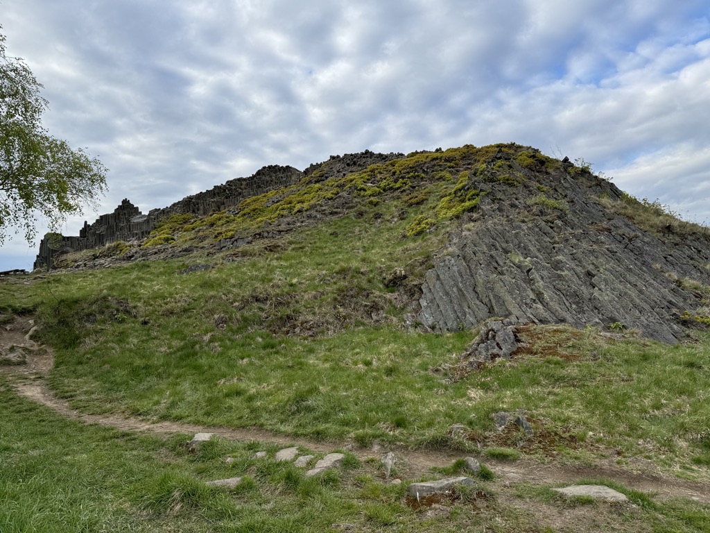
Panská skála, a geologic formation 80 kilometers north of Prague, lies in the historical region of Bohemia in the Czech Republic. Panská skála is like the Giant's causeway, Ireland, or the Devil's Postpile, California. The volcanic formation is in the Central European Volcanic Province, and is thought to have been formed 30 million years ago.
There's a trail leading to the summit.
By elevation Panská skála is
# 46 out of 233 in CHKO České středohoří # 1 out of 1 in NPP Panská skála # 64 out of 197 in CHKO Lužické hory
By prominence Panská skála is
# 1 out of 1 in NPP Panská skála # 88 out of 197 in CHKO Lužické hory
We use GPS information embedded into the photo when it is available.
3D mountains overlay
Adjust mountain panorama to perfectly match your photos because recorded by camera photo position might be imprecise.
Move tool
Rotate tool
Zoom
More customization
Choose which peak labels should make into the final photo and what photo title should be.
Next
Photo Location
Satellitte
Flat map
Relief map
Latitude
Longitude
Altitude
OR
Latitude
°'''
Longitude
°'''
Apply
Register Peak
Peak Name
Latitude
Longitude
Altitude
Register
Teleport
PeakVisor
This 3D model of Sagarmatha National Park in Nepal was made using the PeakVisor app topographic data. The mobile app features higher precision models worldwide, more topographic details, and works offline. Download PeakVisor maps today.
Download OBJ model
PeakVisor
The download should start shortly. If you find it useful please consider supporting the PeakVisor app.
PeakVisor for iOS and Android
Be a superhero of outdoor navigation with state-of-the-art 3D maps and mountain identification in the palm of your hand!


_edit.jpg)
.jpg)
.jpg)
.jpg)
.jpg)

.jpg)